Cof Cymru: National Historic Assets of Wales · Wales
No 7 Church Row
Maescar, Powys, Wales
A Grade II listed building in Defynnog, Brecon, Maescar, Powys, designated on 8 November 1985.
The record
- Designation
- Listed building, Grade II
- Broad class
- Domestic
- Date of designation
- 8 November 1985
- Locality
- Defynnog
- Town
- Brecon
- Community
- Maescar
- Unitary authority
- Powys
- Country
- Wales
- Coordinates
- 51.93962, -3.56422
- Cadw reference
- 86922
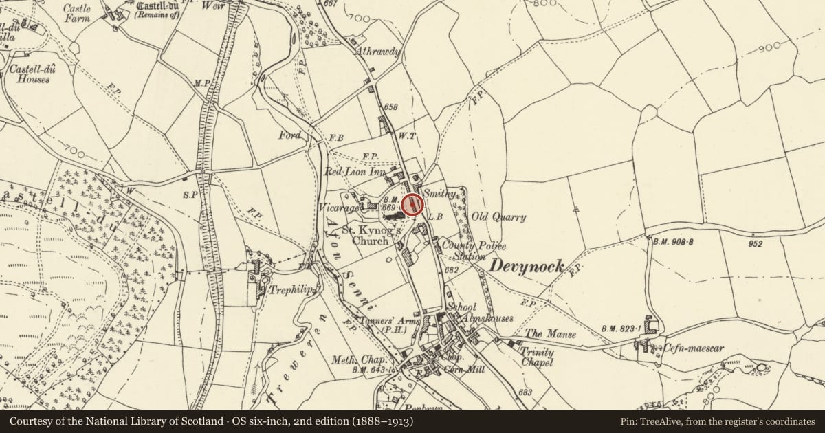
Slide toward Today to fade the historical sheet and see the modern map underneath.
David Rumsey Map Collection, Stanford LibrariesDavid Rumsey Map Collection, Stanford LibrariesDavid Rumsey Map Collection, Stanford LibrariesDavid Rumsey Map Collection, Stanford LibrariesDavid Rumsey Map Collection, Stanford Libraries
5 historical maps cover this location, the earliest the 1636 map "Cornubia : Devonia, Somersetus, Dorcestria, Wiltonia, Glocestria ..." (David Rumsey Map Collection, Stanford Libraries).
Historical maps covering this location
- 1636 · Cornubia : Devonia, Somersetus, Dorcestria, Wiltonia, Glocestria ... (David Rumsey Map Collection, Stanford Libraries)
- 1830 · V.3:11-15:XV. Britisches Reich. A. Kon: England. b. Frstenthum Wales: Shire: 37-40 (David Rumsey Map Collection, Stanford Libraries)
- 1856 · 42. Brecon. (David Rumsey Map Collection, Stanford Libraries)
- 1898 · 213 Brecon (Hills) (David Rumsey Map Collection, Stanford Libraries)
- 1901 · Sheet 14. (David Rumsey Map Collection, Stanford Libraries)
Cadw's description
Location
Situated seventh in terrace of eight houses backing onto the churchyard in Defynnog village.
History
Seventh house of a terrace of eight, built c. 1840 in Tudor style, presumably for one of the gentry estates, but there are buildings marked on the site on a map of 1829. The houses are similar to those in Bull Terrace nearby. No 7 is two-bay by contrast with No 6, but with the projecting gable of No 6 forms a symmetrical five-bay composition.
Exterior
Terrace house, rubble stone with slate deep-eaved roof and red brick right end chimneys. Roof has scallopped eaves board, chimneys were a pair of red brick diagonally set shafts, in a block of four shafts shared with No 6, but only one of the pair and two of the four remain. Two-storey, two-window range, the windows with chamfered jambs and stone sills, two small windows under eaves, over a three-light mullion-and-transom window to right with sandstone hoodmould and a segmental-pointed chamfered doorway with board door and strap hinges to left.
Rear is rendered with hopper-type windows.
Interior not inspected.
Reason for designation
Included for its special architectural interest as one of a distinctive terrace of Tudor style estate cottages.
Nearby in the register
- No 6 Church RowDomesticunder 1 mi
- Cynnog Cottage, No 8 Church RowDomesticunder 1 mi
- No 5 Church RowDomesticunder 1 mi
- Clifford Place, No 4 Church RowDomesticunder 1 mi
Other entries of the same register within about three miles of this one, by straight line.