Cof Cymru: National Historic Assets of Wales · Wales
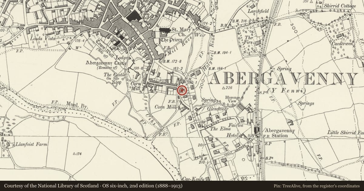
43 Monmouth Road
Abergavenny, Monmouthshire, Wales
A Grade II listed building in Abergavenny, Monmouthshire, designated on 10 November 2005.
The record
- Designation
- Listed building, Grade II
- Broad class
- No class recorded
- Date of designation
- 10 November 2005
- Locality
- Abergavenny
- Town
- Abergavenny
- Community
- Abergavenny
- Unitary authority
- Monmouthshire
- Country
- Wales
- Coordinates
- 51.81878, -3.01444
- Cadw reference
- 86825
Slide toward Today to fade the historical sheet and see the modern map underneath.
David Rumsey Map Collection, Stanford LibrariesDavid Rumsey Map Collection, Stanford LibrariesDavid Rumsey Map Collection, Stanford LibrariesDavid Rumsey Map Collection, Stanford LibrariesDavid Rumsey Map Collection, Stanford Libraries
5 historical maps cover this location, the earliest the 1636 map "Cornubia : Devonia, Somersetus, Dorcestria, Wiltonia, Glocestria ..." (David Rumsey Map Collection, Stanford Libraries).
Historical maps covering this location
- 1636 · Cornubia : Devonia, Somersetus, Dorcestria, Wiltonia, Glocestria ... (David Rumsey Map Collection, Stanford Libraries)
- 1856 · 42. Brecon. (David Rumsey Map Collection, Stanford Libraries)
- 1898 · 232 Abergavenny (Hills) (David Rumsey Map Collection, Stanford Libraries)
- 1898 · 232 Abergavenny (Outline) (David Rumsey Map Collection, Stanford Libraries)
- 1901 · Sheet 14. (David Rumsey Map Collection, Stanford Libraries)
Cadw's description
Location
Beside the river Gavenny on the old road into Abergavenny from the south and east and about 500m from the town centre.
History
Early C19 house which may be an alteration and heightening of an older property. This was probably the miller's house of the water mill which once stood adjacent to it.
Exterior
Wholly rendered and painted facades with a Welsh slate roof and rendered stacks. Single depth central entry plan with a rear outshut. Three storeys, two windows , with the door off-centre to right. This is panelled and has a gabled porch with very delicate iron posts. Tripartite sash to left with 2 over 2 panes flanking 6 over 6, and a modern 2 over 2 pane sash to right. The upper windows are 8 over 8 pane sashes with plat band between. Plain roof with ridge stacks. The rear elevation has been altered and refeatured.
Interior
Interior not inspected at resurvey.
Reason for designation
Included for its special interest as a well preserved early C19 house with definite character, which has additional interest as the probable mill-house of an adjacent water-mill.
Nearby in the register
- House, including garden walls with terracotta dressings and pinecone finialsNo class recordedunder 1 mi
- House, including garden walls with terracotta dressings and pinecone finialsNo class recordedunder 1 mi
- Asthal House, including garden steps, gates and walls with terracotta dressingsNo class recordedunder 1 mi
- House, including garden walls with terracotta dressings and ball finialsNo class recordedunder 1 mi
Other entries of the same register within about three miles of this one, by straight line.