Cof Cymru: National Historic Assets of Wales · Wales
Tyn-y-gerddi
Llanfair Caereinion, Powys, Wales
A Grade II listed building in Pentyrch, Llanfair Caereinion, Powys, designated on 19 December 1986.
The record
- Designation
- Listed building, Grade II
- Broad class
- Domestic
- Date of designation
- 19 December 1986
- Locality
- Pentyrch
- Community
- Llanfair Caereinion
- Unitary authority
- Powys
- Country
- Wales
- Coordinates
- 52.66559, -3.38758
- Cadw reference
- 8681
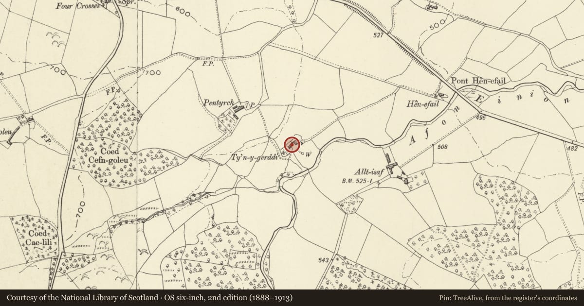
Slide toward Today to fade the historical sheet and see the modern map underneath.
David Rumsey Map Collection, Stanford LibrariesDavid Rumsey Map Collection, Stanford LibrariesLlyfrgell Genedlaethol Cymru – The National Library of WalesDavid Rumsey Map Collection, Stanford LibrariesDavid Rumsey Map Collection, Stanford Libraries
5 historical maps cover this location, the earliest the 1637 map "Particular description of Wales. Cambria seu Wallia" (David Rumsey Map Collection, Stanford Libraries).
Historical maps covering this location
- 1637 · Particular description of Wales. Cambria seu Wallia (David Rumsey Map Collection, Stanford Libraries)
- 1795 · To Sir Watkin Williams-Wynn Bart ... the map of the six counties of North Wales is most… (Llyfrgell Genedlaethol Cymru – The National Library of Wales)
- 1883 · Watershed map England, Wales 3. (David Rumsey Map Collection, Stanford Libraries)
- 1899 · 150 Dinas-Mawddwy (Hills) (David Rumsey Map Collection, Stanford Libraries)
- 1901 · Sheet 9 and 10. (David Rumsey Map Collection, Stanford Libraries)
Cadw's description
Location
Farmhouse, (previously within farm complex), alongside a track S A458, 4km NW of Llanfair Caereinion.
Exterior
History: Late C16? S bay possibly dates from mid C17.
Exterior: Timber framed with plaster panel infill; thatched roof with (rebuilt) brick axial stack. Two storeys, 3 unit lobby entry plan. Two bays to the N (including the entrance bay) are close-studded with a mid-rail, on a stone plinth; the lower storey timbers in the entrance bay have been replaced in brick. Square panelled framing in S bays which may be a later addition; some of the timbers now replaced. Partial survival of close-studded framing in the rear elevation, the rest rebuilt in brick. Windows are modern casements, largely in earlier openings.
Interior: Access not possible at time of inspection (October 1995).
Listed as a well preserved and little altered example of late C16 farmhouse.
Reference: Royal Commission on Ancient and Historical Monuments (Wales): Files, drawing of interior.
Nearby in the register
- HenefailDomesticunder 1 mi
- Pentyrch SmithyCommercialunder 1 mi
- Rhos-y-GweisionDomesticunder 1 mi
- Melin-y-grugDomesticunder 1 mi
Other entries of the same register within about three miles of this one, by straight line.