Cof Cymru: National Historic Assets of Wales · Wales
Cruck Barn at Rhosfawr
Llanfyllin, Powys, Wales
A Grade II* listed building in Cwm Nant Fyllon, Llanfyllin, Powys, designated on 22 March 1993.
The record
- Designation
- Listed building, Grade II*
- Broad class
- Agriculture and Subsistence
- Date of designation
- 22 March 1993
- Locality
- Cwm Nant Fyllon
- Community
- Llanfyllin
- Unitary authority
- Powys
- Country
- Wales
- Coordinates
- 52.78470, -3.34074
- Cadw reference
- 8641
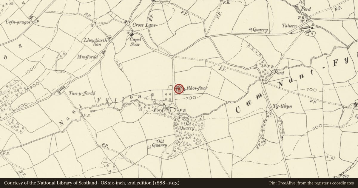
Slide toward Today to fade the historical sheet and see the modern map underneath.
David Rumsey Map Collection, Stanford LibrariesDavid Rumsey Map Collection, Stanford LibrariesLlyfrgell Genedlaethol Cymru – The National Library of WalesDavid Rumsey Map Collection, Stanford LibrariesDavid Rumsey Map Collection, Stanford Libraries
5 historical maps cover this location, the earliest the 1608 map "(13) Cambriae Typus." (David Rumsey Map Collection, Stanford Libraries).
Historical maps covering this location
- 1608 · (13) Cambriae Typus. (David Rumsey Map Collection, Stanford Libraries)
- 1795 · To Sir Watkin Williams-Wynn Bart ... the map of the six counties of North Wales is most… (Llyfrgell Genedlaethol Cymru – The National Library of Wales)
- 1883 · Watershed map England, Wales 3. (David Rumsey Map Collection, Stanford Libraries)
- 1897 · 137 Oswestry (Hills) (David Rumsey Map Collection, Stanford Libraries)
- 1901 · Sheet 9 and 10. (David Rumsey Map Collection, Stanford Libraries)
Cadw's description
Location
To E and at right angles to farmhouse.
History
Late C15 or early C16 timber framed hall house now used as barn. Used as barn since C17 and never altered by insertion of floors or chimney.
Exterior
Aligned NW-SE down slope of ground with timber framing set on stone platform which levels site. Timber framing clad in corrugated iron, front slope of roof has corrugated covering, rear retains slates.
Interior
Four bays, crucks at gables and central truss, box frame trusses with collar and tie beams at dais partition and passage partition; two tiers of trenched purlins with heavy curved wind braces (some missing). Partially lofted to lower end. Central bays form hall, large lower bay (with own exterior door) was probably chamber rather than byre since access to exterior difficult for animals. Two small rooms behind dais partition probably service rooms.
Some details of interior hidden behind cladding.
Reason for designation
Graded II* as perhaps most complete and unaltered medium sized hall house in Wales.
Nearby in the register
- Talwrn FarmhouseDomesticunder 1 mi
- LlwynglasDomesticunder 1 mi
- Ty CerrigDomesticunder 1 mi
- Cornorion FawrDomesticunder 1 mi
Other entries of the same register within about three miles of this one, by straight line.