Cof Cymru: National Historic Assets of Wales · Wales
6 Glamorgan Street
Brecon, Powys, Wales
A Grade II* listed building in Brecon, Powys, designated on 16 January 1952.
The record
- Designation
- Listed building, Grade II*
- Broad class
- No class recorded
- Date of designation
- 16 January 1952
- Town
- Brecon
- Community
- Brecon
- Unitary authority
- Powys
- Country
- Wales
- Coordinates
- 51.94633, -3.39012
- Cadw reference
- 85694
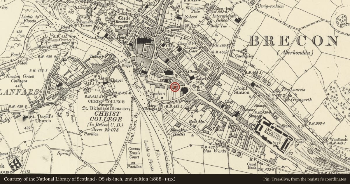
Slide toward Today to fade the historical sheet and see the modern map underneath.
David Rumsey Map Collection, Stanford LibrariesDavid Rumsey Map Collection, Stanford LibrariesDavid Rumsey Map Collection, Stanford LibrariesDavid Rumsey Map Collection, Stanford LibrariesDavid Rumsey Map Collection, Stanford Libraries
5 historical maps cover this location, the earliest the 1608 map "(13) Cambriae Typus." (David Rumsey Map Collection, Stanford Libraries).
Historical maps covering this location
- 1608 · (13) Cambriae Typus. (David Rumsey Map Collection, Stanford Libraries)
- 1636 · Cornubia : Devonia, Somersetus, Dorcestria, Wiltonia, Glocestria ... (David Rumsey Map Collection, Stanford Libraries)
- 1856 · 42. Brecon. (David Rumsey Map Collection, Stanford Libraries)
- 1898 · 213 Brecon (Hills) (David Rumsey Map Collection, Stanford Libraries)
- 1901 · Sheet 14. (David Rumsey Map Collection, Stanford Libraries)
Cadw's description
Location
The first houses to W of Brecknock Museum.
History
No 6 is an early C 18th house century re-fronted in early to mid 19th century to form a pair with No 5; No 5 which retains few internal features of interest and which is not shown fully on the Plan of Brecknock of 1834 was possibly built entirely at this date.
Exterior
Former pair of houses now converted to flats. Rendered; bands at second and first floor sill levels; rusticated quoins; plinth. Slate roof, stone chimneys. Three storey, 6 window front to Glamorgan Street; shallow projecting bays to ends. Windows with moulded architraves; sash windows three panes wide in reveals, on first floor with horns. Two adjoining doorways in centre, half-glazed panelled doors with side lights and plain semi-circular fanlights recessed in semi-circular headed arches with keystones and pilasters. Rear elevation with three broad gables, each of 2 windows breadth (small-pane sashes), extra narrow window to end bay of number 6; single-storey lean-to in central bay.
Interior
Interiors not readily accessible as now divided between several flats. Inside, No 6 retains early to mid C18 date; staircase with ‘barley-sugar’ twisted balusters. Said also to retain, in rear ground floor room, fireplace with shouldered architrave and egg and dart course; panelled walls; enriched plaster ceiling.
Reason for designation
A pair of town houses, retaining historic character. Graded II* for the special interest of early-to mid C18 internal features of No.6. Group Value with adjacent listed buildings.
Nearby in the register
- 5 Glamorgan StreetDomesticunder 1 mi
- Garden Wall to rear of No 5Domesticunder 1 mi
- 4 Glamorgan StreetNo class recordedunder 1 mi
- Wellington Hotel including rear wingsCommercialunder 1 mi
Other entries of the same register within about three miles of this one, by straight line.