Cof Cymru: National Historic Assets of Wales · Wales
Moss Villa
Bronington, Wrexham, Wales
A Grade II listed building in Bronington, Wrexham, designated on 20 October 2005.
The record
- Designation
- Listed building, Grade II
- Broad class
- No class recorded
- Date of designation
- 20 October 2005
- Locality
- Bronington
- Community
- Bronington
- Unitary authority
- Wrexham
- Country
- Wales
- Coordinates
- 52.93345, -2.76744
- Cadw reference
- 85475
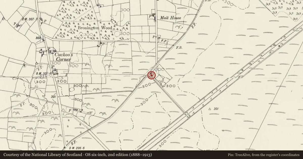
Slide toward Today to fade the historical sheet and see the modern map underneath.
David Rumsey Map Collection, Stanford LibrariesDavid Rumsey Map Collection, Stanford LibrariesDavid Rumsey Map Collection, Stanford LibrariesDavid Rumsey Map Collection, Stanford LibrariesDavid Rumsey Map Collection, Stanford Libraries
5 historical maps cover this location, the earliest the 1637 map "Particular description of Wales. Cambria seu Wallia" (David Rumsey Map Collection, Stanford Libraries).
Historical maps covering this location
- 1637 · Particular description of Wales. Cambria seu Wallia (David Rumsey Map Collection, Stanford Libraries)
- 1861 · 73. Market Drayton. (David Rumsey Map Collection, Stanford Libraries)
- 1883 · Watershed map England, Wales 3. (David Rumsey Map Collection, Stanford Libraries)
- 1897 · 122 Nantwich (Hills) (David Rumsey Map Collection, Stanford Libraries)
- 1901 · Sheet 9 and 10. (David Rumsey Map Collection, Stanford Libraries)
Cadw's description
Location
Just beyond the S end of Chapel Lane, on the S side of a private track and on the edge of Maelor Forest, approximately 1.7km SSW of the parish church.
History
A mid C19 Hanmer estate cottage, first shown on the 1873 Ordnance Survey.
Exterior
A 1½-storey cottage of brick with slate roof on overhanging eaves, and brick ridge stack. Above the windows is a sawtooth band in each elevation. Openings have segmental heads, and windows are casements with wood mullions. The gable end entrance has a central boarded door and a 2-light window above. The L side wall has a 2-light window and small window beneath the eaves. The R side has two 3-light windows, of which the R-hand has been renewed. In the rear gable end is a boarded door on the L side and 2-light windows to the R and above.
Interior
Not inspected.
Reason for designation
Listed for its special interest as a well preserved simple C19 estate cottage, a type characteristic of the district.
Nearby in the register
- Former stable and coach house at Green Dragon FarmNo class recordedunder 1 mi
- Green Dragon FarmhouseNo class recordedunder 1 mi
- Peat Processing Works, Fenn's MossIndustrial buildingunder 1 mi
- Fenn's Moss Peat Processing WorksNo class recordedunder 1 mi
Other entries of the same register within about three miles of this one, by straight line.