Cof Cymru: National Historic Assets of Wales · Wales
Green Dragon Farmhouse
Bronington, Wrexham, Wales
A Grade II listed building in Bronington, Wrexham, designated on 20 October 2005.
The record
- Designation
- Listed building, Grade II
- Broad class
- No class recorded
- Date of designation
- 20 October 2005
- Locality
- Bronington
- Community
- Bronington
- Unitary authority
- Wrexham
- Country
- Wales
- Coordinates
- 52.94347, -2.77267
- Cadw reference
- 85463
Slide toward Today to fade the historical sheet and see the modern map underneath.
David Rumsey Map Collection, Stanford LibrariesDavid Rumsey Map Collection, Stanford LibrariesDavid Rumsey Map Collection, Stanford LibrariesDavid Rumsey Map Collection, Stanford LibrariesDavid Rumsey Map Collection, Stanford Libraries
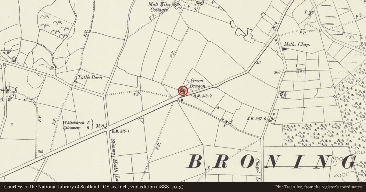
5 historical maps cover this location, the earliest the 1637 map "Particular description of Wales. Cambria seu Wallia" (David Rumsey Map Collection, Stanford Libraries).
Historical maps covering this location
- 1637 · Particular description of Wales. Cambria seu Wallia (David Rumsey Map Collection, Stanford Libraries)
- 1861 · 73. Market Drayton. (David Rumsey Map Collection, Stanford Libraries)
- 1883 · Watershed map England, Wales 3. (David Rumsey Map Collection, Stanford Libraries)
- 1897 · 122 Nantwich (Hills) (David Rumsey Map Collection, Stanford Libraries)
- 1901 · Sheet 9 and 10. (David Rumsey Map Collection, Stanford Libraries)
Cadw's description
Location
Prominently sited set back on the W side of the road approximately 1km SW of Bronington church.
History
An early C19 public house shown on the 1839 Tithe map and 1873 Ordnance Survey. Now a farmhouse.
Exterior
A 2-storey 3-window brick farmhouse with renewed slate roof and 3 brick stacks. The asymmetrical front is divided into a single-fronted unit on the L side and double-fronted unit occupying the centre and R. Windows are 3-light casements with sills, probably replacements in original openings, under segmental heads in the lower storey and beneath the eaves in the upper storey. The central window is slightly offset to the L of centre, and to its R is the offset entrance to the larger unit. This and the entrance to the L-hand unit both have boarded doors under gabled canopies.
A narrower and lower parallel rear wing has replacement windows.
Reason for designation
Listed for its special architectural interest as a prominent former roadside public house retaining definite C19 character, forming a strong group with the stable and coach house.
Nearby in the register
- Former stable and coach house at Green Dragon FarmNo class recordedunder 1 mi
- Maesllwyn HouseDomesticunder 1 mi
- The Vicarage, including attached garden wallNo class recordedunder 1 mi
- Church of the Holy TrinityReligious, Ritual and Funeraryunder 1 mi
Other entries of the same register within about three miles of this one, by straight line.