Cof Cymru: National Historic Assets of Wales · Wales
Osbaston Weir
Monmouth, Monmouthshire, Wales
A Grade II listed building in Osbaston, Monmouth, Monmouthshire, designated on 10 August 2005.
The record
- Designation
- Listed building, Grade II
- Broad class
- Industrial
- Date of designation
- 10 August 2005
- Locality
- Osbaston
- Town
- Monmouth
- Community
- Monmouth
- Unitary authority
- Monmouthshire
- Country
- Wales
- Coordinates
- 51.82119, -2.72514
- Cadw reference
- 85222
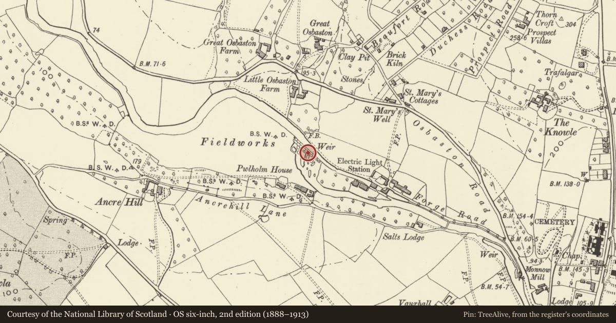
Slide toward Today to fade the historical sheet and see the modern map underneath.
David Rumsey Map Collection, Stanford LibrariesDavid Rumsey Map Collection, Stanford LibrariesDavid Rumsey Map Collection, Stanford LibrariesDavid Rumsey Map Collection, Stanford LibrariesDavid Rumsey Map Collection, Stanford Libraries
5 historical maps cover this location, the earliest the 1636 map "Cornubia : Devonia, Somersetus, Dorcestria, Wiltonia, Glocestria ..." (David Rumsey Map Collection, Stanford Libraries).
Historical maps covering this location
- 1636 · Cornubia : Devonia, Somersetus, Dorcestria, Wiltonia, Glocestria ... (David Rumsey Map Collection, Stanford Libraries)
- 1830 · V.3:11-15:XV.Britisches Reich. A. Kon: England. a. England ab sich: Shire:15-17, 33 (David Rumsey Map Collection, Stanford Libraries)
- 1895 · Sheet 11. Ordnance Survey of England and Wales. (David Rumsey Map Collection, Stanford Libraries)
- 1896 · 233 Monmouth (Hills) (David Rumsey Map Collection, Stanford Libraries)
- 1901 · Sheet 14. (David Rumsey Map Collection, Stanford Libraries)
Cadw's description
Location
Across the River Monnow and reached by footpath 150m north of the end of Forge Road on the north side of the town.
History
The first mill is recorded on the site in 1628, but this major construction dates probably from the later C18 and provided power for Monmouth Forge. The site was converted to electricity generation in 1899 when turbines were installed, and the sluice gear at the east end of the weir will have been part of this use.
Exterior
Large stone weir running across the River Monnow and giving a fall of about 3-4m. Dam with concrete top and sandstone and other rubble slope with spillway at the west end and sluice at the north end. The whole construction is about 100m in length and is a considerable piece of engineering.
Reason for designation
Included for its special historic interest as a probably late C18 weir associated with Monmouth Forge and Generating Station.
Nearby in the register
- Osbaston HouseDomesticunder 1 mi
- Salts LodgeDomesticunder 1 mi
- Vauxhall FarmhouseNo class recordedunder 1 mi
- Monnow MillIndustrialunder 1 mi
Other entries of the same register within about three miles of this one, by straight line.