Cof Cymru: National Historic Assets of Wales · Wales
Gatepiers, Gates and Railings of Wesleyan Methodist Chapel
Monmouth, Monmouthshire, Wales
A Grade II listed building in Monmouth, Monmouthshire, designated on 10 August 2005.
The record
- Designation
- Listed building, Grade II
- Broad class
- Religious, Ritual and Funerary
- Date of designation
- 10 August 2005
- Locality
- Monmouth
- Town
- Monmouth
- Community
- Monmouth
- Unitary authority
- Monmouthshire
- Country
- Wales
- Coordinates
- 51.81253, -2.71146
- Cadw reference
- 85200
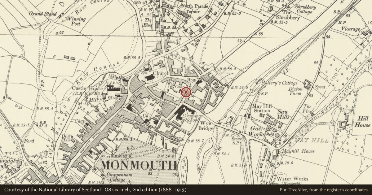
Slide toward Today to fade the historical sheet and see the modern map underneath.
David Rumsey Map Collection, Stanford LibrariesDavid Rumsey Map Collection, Stanford LibrariesDavid Rumsey Map Collection, Stanford LibrariesDavid Rumsey Map Collection, Stanford LibrariesDavid Rumsey Map Collection, Stanford Libraries
5 historical maps cover this location, the earliest the 1636 map "Cornubia : Devonia, Somersetus, Dorcestria, Wiltonia, Glocestria ..." (David Rumsey Map Collection, Stanford Libraries).
Historical maps covering this location
- 1636 · Cornubia : Devonia, Somersetus, Dorcestria, Wiltonia, Glocestria ... (David Rumsey Map Collection, Stanford Libraries)
- 1830 · V.3:11-15:XV.Britisches Reich. A. Kon: England. a. England ab sich: Shire:15-17, 33 (David Rumsey Map Collection, Stanford Libraries)
- 1895 · Sheet 11. Ordnance Survey of England and Wales. (David Rumsey Map Collection, Stanford Libraries)
- 1896 · 233 Monmouth (Hills) (David Rumsey Map Collection, Stanford Libraries)
- 1901 · Sheet 14. (David Rumsey Map Collection, Stanford Libraries)
Cadw's description
Location
Prominently sited within the linear group of historic buildings leading to St. James's Square on the east side of Monmouth and about 300m east of the town centre. The railings follow the street line with the Chapel set back in a courtyard.
History
Probably 1837 and contemporary with the chapel (qv) which is set back behind them.
Exterior
Rendered and painted brick with cast iron railings and gates. Three square piers with panelled faces , projecting cornices and square caps. Panel of spear head railings on dwarf wall to right. Double gates with spear finials to left.
Reason for designation
Included for its group value with the chapel and all the other historic buildings in St. James' Street.
Nearby in the register
- The HameDomesticunder 1 mi
- 16 St. James' StreetEducationunder 1 mi
- Clent HouseDomesticunder 1 mi
- 18 St. James' StreetDomesticunder 1 mi
Other entries of the same register within about three miles of this one, by straight line.