Cof Cymru: National Historic Assets of Wales · Wales
Clent House
Monmouth, Monmouthshire, Wales
A Grade II listed building in Monmouth, Monmouthshire, designated on 27 June 1952.
The record
- Designation
- Listed building, Grade II
- Broad class
- Domestic
- Date of designation
- 27 June 1952
- Locality
- Monmouth
- Town
- Monmouth
- Community
- Monmouth
- Unitary authority
- Monmouthshire
- Country
- Wales
- Coordinates
- 51.81245, -2.71124
- Cadw reference
- 2332
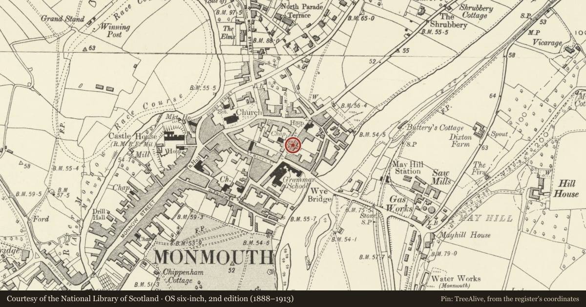
Slide toward Today to fade the historical sheet and see the modern map underneath.
David Rumsey Map Collection, Stanford LibrariesDavid Rumsey Map Collection, Stanford LibrariesDavid Rumsey Map Collection, Stanford LibrariesDavid Rumsey Map Collection, Stanford LibrariesDavid Rumsey Map Collection, Stanford Libraries
5 historical maps cover this location, the earliest the 1636 map "Cornubia : Devonia, Somersetus, Dorcestria, Wiltonia, Glocestria ..." (David Rumsey Map Collection, Stanford Libraries).
Historical maps covering this location
- 1636 · Cornubia : Devonia, Somersetus, Dorcestria, Wiltonia, Glocestria ... (David Rumsey Map Collection, Stanford Libraries)
- 1830 · V.3:11-15:XV.Britisches Reich. A. Kon: England. a. England ab sich: Shire:15-17, 33 (David Rumsey Map Collection, Stanford Libraries)
- 1895 · Sheet 11. Ordnance Survey of England and Wales. (David Rumsey Map Collection, Stanford Libraries)
- 1896 · 233 Monmouth (Hills) (David Rumsey Map Collection, Stanford Libraries)
- 1901 · Sheet 14. (David Rumsey Map Collection, Stanford Libraries)
Cadw's description
Location
Prominently sited within the linear group of historic buildings leading to St. James's Square on the east side of Monmouth and about 300m east of the town centre.
History
Early/midC18, and apparently built very closely in date with No. 3 (qv), both were then re-featured in c1800. The street elevation has been re-windowed since, and there are some changes to the rear elevation.
Exterior
Red brick with floor bands, Welsh slate roof. Double depth plan with entry to right. Three storeys and attic, three windows set almost flush with the wall, 6 over 6 pane sashes under segmental arches, the sashes are late C20 replacements. Doric doorcase with pediment and radiating fanlight, 6-panel door.
Swept gabled dormer which is early C18 in character, paired stacks on left gable.
Rear elevation is partly obscured by an extension. Tall stair window, mullion-and-transom window, both C19. Swept gabled dormers with 2 x 2 pane casement, this is early C18 in character.
Interior
Interior not available at resurvey.
Reason for designation
Included for its special architectural interest as an C18 house of definite character near Monmouth town centre.
Nearby in the register
- 3 St. James' StreetDomesticunder 1 mi
- 7 St. James' StreetDomesticunder 1 mi
- Gatepiers, Gates and Railings of Wesleyan Methodist ChapelReligious, Ritual and Funeraryunder 1 mi
- 9 St. James' StreetDomesticunder 1 mi
Other entries of the same register within about three miles of this one, by straight line.