Cof Cymru: National Historic Assets of Wales · Wales
Goolden's Warehouse at Clafton Bridge
Llandysilio, Powys, Wales
A Grade II listed building in Clafton Bridge, Llandysilio, Powys, designated on 5 April 1993.
The record
- Designation
- Listed building, Grade II
- Broad class
- Commercial
- Date of designation
- 5 April 1993
- Locality
- Clafton Bridge
- Community
- Llandysilio
- Unitary authority
- Powys
- Country
- Wales
- Coordinates
- 52.75972, -3.09094
- Cadw reference
- 8517
Slide toward Today to fade the historical sheet and see the modern map underneath.
David Rumsey Map Collection, Stanford LibrariesDavid Rumsey Map Collection, Stanford LibrariesDavid Rumsey Map Collection, Stanford LibrariesDavid Rumsey Map Collection, Stanford LibrariesLlyfrgell Genedlaethol Cymru – The National Library of Wales
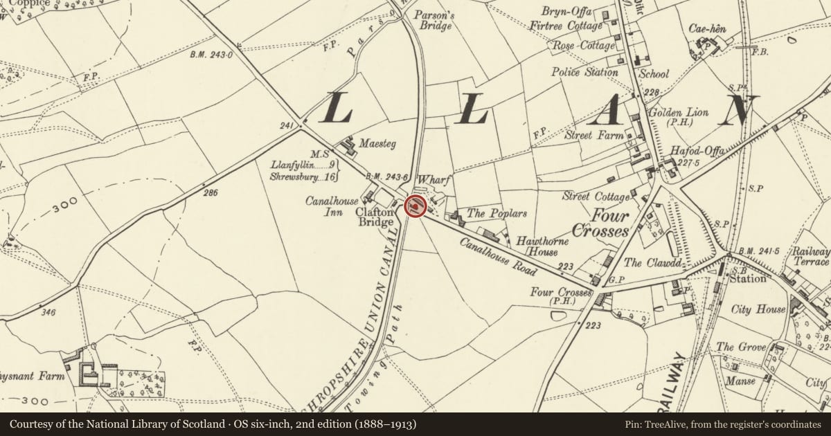
5 historical maps cover this location, the earliest the 1795 map "To Sir Watkin Williams-Wynn Bart ... the map of the six counties of North Wales is most humbly inscribed by his obedient humble servant" (Llyfrgell Genedlaethol Cymru – The National Library of Wales).
Historical maps covering this location
- 1795 · To Sir Watkin Williams-Wynn Bart ... the map of the six counties of North Wales is most… (Llyfrgell Genedlaethol Cymru – The National Library of Wales)
- 1883 · Watershed map England, Wales 3. (David Rumsey Map Collection, Stanford Libraries)
- 1897 · 137 Oswestry (Hills) (David Rumsey Map Collection, Stanford Libraries)
- 1901 · Sheet 9 and 10. (David Rumsey Map Collection, Stanford Libraries)
- 1916 · Sheet 60. Shrewsbury. (David Rumsey Map Collection, Stanford Libraries)
Cadw's description
Location
Attached to south east corner of Clafton Bridge parapet.
History
Built 1836 by Richard Goolden, trader and flannel-maker from Welshpool, (together with much altered wharfinger's house to rear).
Exterior
Two storey, rubble building with gable end to Montgomeryshire Canal. Slate roof, plain bargeboards, plank and battened upper gable opening under loading doors over offset ground floor doors, brick repairs, wooden upper window. Stonework arched window to ground floor right. Timber eaves course with stubs of crane supports at canal end. Plank built doors at road level to rear.
Reason for designation
Included for group value with other listed items at Clafton Bridge.
Nearby in the register
- Nos.1-12 (consec) Canal CottagesDomesticunder 1 mi
- Clafton Bridge (No.100) & attached Parapets Flanking Road ApproachesTransportunder 1 mi
- Parson's Bridge (No.99) over Montgomeryshire CanalTransportunder 1 mi
- War MemorialCommemorativeunder 1 mi
Other entries of the same register within about three miles of this one, by straight line.