Cof Cymru: National Historic Assets of Wales · Wales
115 Main Street
Pembroke, Pembrokeshire, Wales
A Grade II listed building in Pembroke, Pembrokeshire, designated on 29 July 2005.
The record
- Designation
- Listed building, Grade II
- Broad class
- Domestic
- Date of designation
- 29 July 2005
- Locality
- Pembroke
- Community
- Pembroke
- Unitary authority
- Pembrokeshire
- Country
- Wales
- Coordinates
- 51.67436, -4.91073
- Cadw reference
- 84959
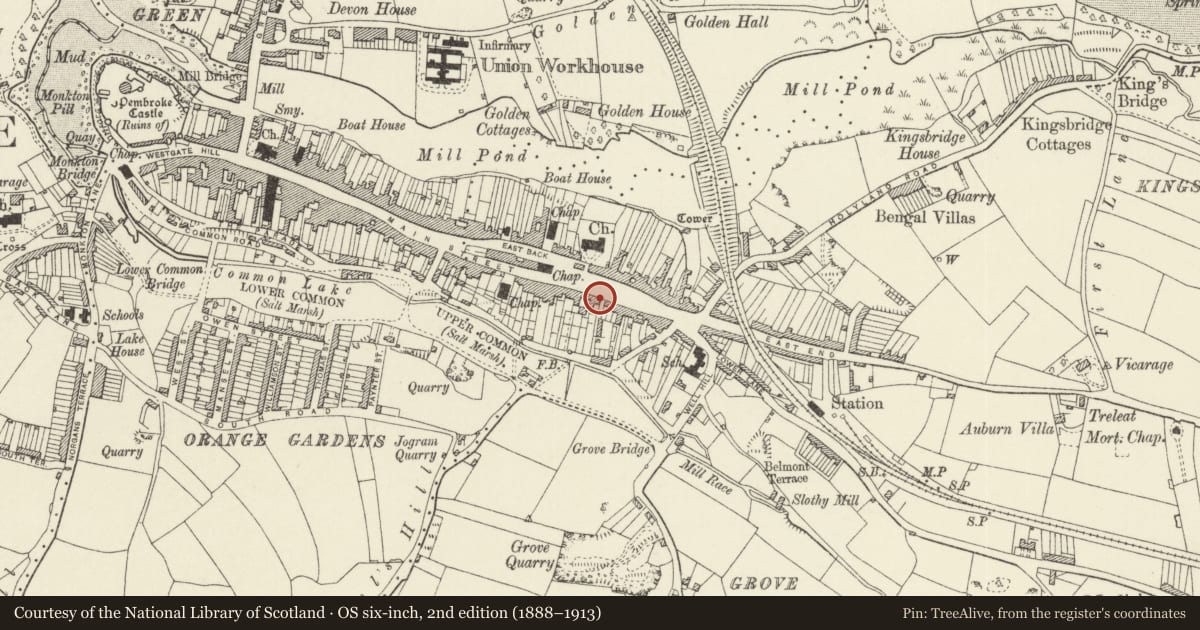
Slide toward Today to fade the historical sheet and see the modern map underneath.
David Rumsey Map Collection, Stanford LibrariesDavid Rumsey Map Collection, Stanford LibrariesDavid Rumsey Map Collection, Stanford LibrariesDavid Rumsey Map Collection, Stanford LibrariesDavid Rumsey Map Collection, Stanford Libraries
5 historical maps cover this location, the earliest the 1636 map "Cornubia : Devonia, Somersetus, Dorcestria, Wiltonia, Glocestria ..." (David Rumsey Map Collection, Stanford Libraries).
Historical maps covering this location
- 1636 · Cornubia : Devonia, Somersetus, Dorcestria, Wiltonia, Glocestria ... (David Rumsey Map Collection, Stanford Libraries)
- 1865 · England and Wales. England No. 6. (David Rumsey Map Collection, Stanford Libraries)
- 1891 · Sheet 10. Ordnance Survey of England and Wales. . (David Rumsey Map Collection, Stanford Libraries)
- 1898 · 245 Pembroke (Hills) (David Rumsey Map Collection, Stanford Libraries)
- 1901 · Sheet 13. (David Rumsey Map Collection, Stanford Libraries)
Cadw's description
Location
Set back slightly on the end of a row with Nos 111 and 113 to right. No 115 is lower in scale and steps down from the taller gable end of no 113.
History
Possibly of late Georgian date and going with No 113 adjoining, but now with a mid-Victorian exterior. Interior heavily altered in later C20 for flats. Formerly known as Wesley House, St Michael's Square.
Exterior
Three-storey plus basement house in simple classical style c1870. Three-window stucco façade with lined out coursing, modern tiled roof with end brick stack to left. Upper floor windows have chamfered reveals, roll-moulded lintels and projecting sills; 2-pane plate glass sashes. Ground floor with pilastered and corniced doorcase (converted to narrow sash window) flanked by sash windows with moulded architraves. Plain boarded door down basement steps to left of garden wall.
Enclosed front garden with elaborate later C19 ironwork railings on painted dwarf walls; central ironwork gate up two steps.
Reason for designation
Included for its special architectural interest as the end house to the classical terrace which has an exceptional house at No 111.
Nearby in the register
- 113 Main StreetDomesticunder 1 mi
- Front garden wall & gates to No. 113 Main StreetDomesticunder 1 mi
- PenfroDomesticunder 1 mi
- Front garden wall, railings, gatepiers & gate to No 111, with penny postage stamp machine to rightDomesticunder 1 mi
Other entries of the same register within about three miles of this one, by straight line.