Cof Cymru: National Historic Assets of Wales · Wales
Front garden wall & gates to No. 113 Main Street
Pembroke, Pembrokeshire, Wales
A Grade II listed building in Pembroke, Pembrokeshire, designated on 14 July 1981.
The record
- Designation
- Listed building, Grade II
- Broad class
- Domestic
- Date of designation
- 14 July 1981
- Locality
- Pembroke
- Town
- Pembroke
- Community
- Pembroke
- Unitary authority
- Pembrokeshire
- Country
- Wales
- Coordinates
- 51.67448, -4.91085
- Cadw reference
- 6398
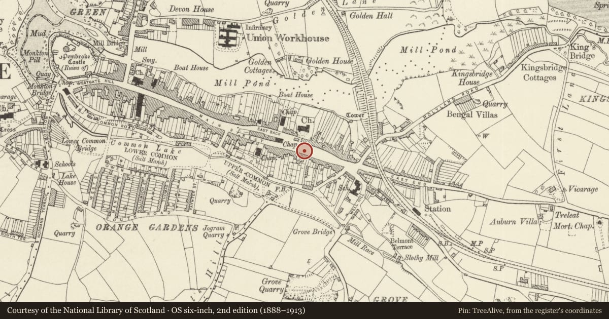
Slide toward Today to fade the historical sheet and see the modern map underneath.
David Rumsey Map Collection, Stanford LibrariesDavid Rumsey Map Collection, Stanford LibrariesDavid Rumsey Map Collection, Stanford LibrariesDavid Rumsey Map Collection, Stanford LibrariesDavid Rumsey Map Collection, Stanford Libraries
5 historical maps cover this location, the earliest the 1636 map "Cornubia : Devonia, Somersetus, Dorcestria, Wiltonia, Glocestria ..." (David Rumsey Map Collection, Stanford Libraries).
Historical maps covering this location
- 1636 · Cornubia : Devonia, Somersetus, Dorcestria, Wiltonia, Glocestria ... (David Rumsey Map Collection, Stanford Libraries)
- 1865 · England and Wales. England No. 6. (David Rumsey Map Collection, Stanford Libraries)
- 1891 · Sheet 10. Ordnance Survey of England and Wales. . (David Rumsey Map Collection, Stanford Libraries)
- 1898 · 245 Pembroke (Hills) (David Rumsey Map Collection, Stanford Libraries)
- 1901 · Sheet 13. (David Rumsey Map Collection, Stanford Libraries)
Cadw's description
Location
In front of No. 113, on the S side of Main Street near its E junction with East Back and opposite the entrance to the Church of Saint Michael.
History
Front garden retaining wall with railings, earlier C19, similar to those on No 111, the original gatepiers replaced in late C20 with square section steel uprights. Railings and gates were in decay in 1981, railings since restored.
Exterior
Front retaining wall, rendered with grey limestone coping. Thick C19 iron railings with spear-headed finials. Wall and railings return to house on E side. Two entries, one to centre one to right, to basement, both with C20 steel gate posts (replacing panelled iron gate posts with Gothic tracery to centre gate and gate with uprights rising above toprail and taller gate to right). Centre gate is reused with spearheads. Right gate is original matching the railings.
Reason for designation
Included for group value with No 113.
Nearby in the register
- 113 Main StreetDomesticunder 1 mi
- 115 Main StreetDomesticunder 1 mi
- PenfroDomesticunder 1 mi
- Front garden wall, railings, gatepiers & gate to No 111, with penny postage stamp machine to rightDomesticunder 1 mi
Other entries of the same register within about three miles of this one, by straight line.