Cof Cymru: National Historic Assets of Wales · Wales
Bodlondeb
Machynlleth, Powys, Wales
A Grade II listed building in Machynlleth, Powys, designated on 19 January 1952.
The record
- Designation
- Listed building, Grade II
- Broad class
- Domestic
- Date of designation
- 19 January 1952
- Community
- Machynlleth
- Unitary authority
- Powys
- Country
- Wales
- Coordinates
- 52.59003, -3.85353
- Cadw reference
- 8493
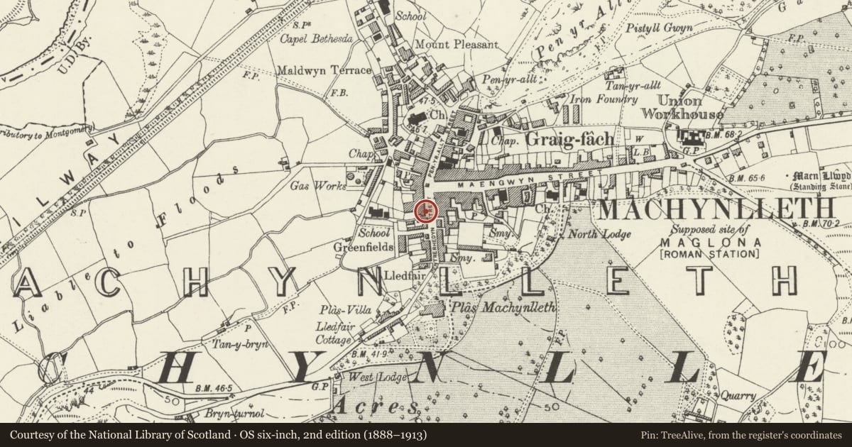
Slide toward Today to fade the historical sheet and see the modern map underneath.
David Rumsey Map Collection, Stanford LibrariesDavid Rumsey Map Collection, Stanford LibrariesDavid Rumsey Map Collection, Stanford LibrariesDavid Rumsey Map Collection, Stanford LibrariesLlyfrgell Genedlaethol Cymru – The National Library of Wales
5 historical maps cover this location, the earliest the 1795 map "To Sir Watkin Williams-Wynn Bart ... the map of the six counties of North Wales is most humbly inscribed by his obedient humble servant" (Llyfrgell Genedlaethol Cymru – The National Library of Wales).
Historical maps covering this location
- 1795 · To Sir Watkin Williams-Wynn Bart ... the map of the six counties of North Wales is most… (Llyfrgell Genedlaethol Cymru – The National Library of Wales)
- 1883 · Watershed map England, Wales 3. (David Rumsey Map Collection, Stanford Libraries)
- 1896 · Sheet 7. Ordnance Survey of England and Wales. (David Rumsey Map Collection, Stanford Libraries)
- 1899 · 149 Barmouth (Hills) (David Rumsey Map Collection, Stanford Libraries)
- 1901 · Sheet 9 and 10. (David Rumsey Map Collection, Stanford Libraries)
Cadw's description
Location
Detached to S of the Clock Tower; railed forecourt.
History
Fine mid Cl8 Georgian former Rectory.
Exterior
3-storey, 3-window rubble frontage with broadly spaced windows; undulating slate roof and massive chimney breast to right gable end with rubble stack and weathercoursing; modern brick stack to left end. l2-pane sash windows of diminishing sizes, those to the ground floor are almost flush; stone lintels. 6-panel door to centre with diamond traceried overlight. Leaning rubble left gable end. Full height lean-to at centre rear; some small pane sashes, part or wholly boarded up. Cl9 gabled ended brick cross range, formerly with further cross range beyond; one boarded up oriel window.
Interior
Internally the original dog-leg staircase is retained with scrolled newel, turned balusters with annulettes, moulded handrail and S shaped tread ends; dado rail opposite in line with balustrade. 6-panel doors.
In poor condition at the time of internal inspection, August l989.
Reason for designation
Group value with other listed items in the town centre.
Nearby in the register
- White Lion HotelCommercialunder 1 mi
- Heol Pentrehedyn (including The Pharmacy)Commercialunder 1 mi
- No. 6 including The PharmacyCommercialunder 1 mi
- Heol PentrehedynDomesticunder 1 mi
Other entries of the same register within about three miles of this one, by straight line.