Cof Cymru: National Historic Assets of Wales · Wales
No. 6 including The Pharmacy
Machynlleth, Powys, Wales
A Grade II listed building in Machynlleth, Powys, designated on 19 November 1990.
The record
- Designation
- Listed building, Grade II
- Broad class
- Commercial
- Date of designation
- 19 November 1990
- Community
- Machynlleth
- Unitary authority
- Powys
- Country
- Wales
- Coordinates
- 52.59032, -3.85363
- Cadw reference
- 8490
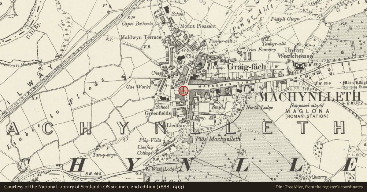
Slide toward Today to fade the historical sheet and see the modern map underneath.
David Rumsey Map Collection, Stanford LibrariesDavid Rumsey Map Collection, Stanford LibrariesDavid Rumsey Map Collection, Stanford LibrariesDavid Rumsey Map Collection, Stanford LibrariesLlyfrgell Genedlaethol Cymru – The National Library of Wales
5 historical maps cover this location, the earliest the 1795 map "To Sir Watkin Williams-Wynn Bart ... the map of the six counties of North Wales is most humbly inscribed by his obedient humble servant" (Llyfrgell Genedlaethol Cymru – The National Library of Wales).
Historical maps covering this location
- 1795 · To Sir Watkin Williams-Wynn Bart ... the map of the six counties of North Wales is most… (Llyfrgell Genedlaethol Cymru – The National Library of Wales)
- 1883 · Watershed map England, Wales 3. (David Rumsey Map Collection, Stanford Libraries)
- 1896 · Sheet 7. Ordnance Survey of England and Wales. (David Rumsey Map Collection, Stanford Libraries)
- 1899 · 149 Barmouth (Hills) (David Rumsey Map Collection, Stanford Libraries)
- 1901 · Sheet 9 and 10. (David Rumsey Map Collection, Stanford Libraries)
Cadw's description
Location
Situated close to the clock tower between White Lion Hotel and Barclays Bank.
History
Probably early Cl8 origins, sub-divided and altered in Cl9.
Exterior
3-storey, 6-window coursed rubble front; slate roof, dentil eaves band and dark brick chimney stack to left. 2 gables with applied half timbering and hook finials flank the centre. Sash windows; small pane to upper sashes of gables, 9-pane to remaining 2nd floor windows, 4-pane below except for the extreme left where a square bay has been added. 6-panel door with traceried overlight to No 6; half glazed door to No 8. Modern shop front and broad boarded doors to the centre.
Post and panel rear wall to the pantry. Cl9 stairs; chamfered beams to lst floor later plastered or boxed. Lath and plaster partition walls to the attic; windlass indicates possible former use as a warehouse. May have originally been two houses and shops to the ground floor with one large and one small living unit above.
Reason for designation
Included for group value
Nearby in the register
- Heol Pentrehedyn (including The Pharmacy)Commercialunder 1 mi
- Barclays BankCommercialunder 1 mi
- White Lion HotelCommercialunder 1 mi
- 1 Heol PenralltCommercialunder 1 mi
Other entries of the same register within about three miles of this one, by straight line.