Cof Cymru: National Historic Assets of Wales · Wales
Deildy (also known as West Lodge)
Machynlleth, Powys, Wales
A Grade II listed building in Machynlleth, Powys, designated on 19 November 1990.
The record
- Designation
- Listed building, Grade II
- Broad class
- Domestic
- Date of designation
- 19 November 1990
- Community
- Machynlleth
- Unitary authority
- Powys
- Country
- Wales
- Coordinates
- 52.58704, -3.85612
- Cadw reference
- 8488
Slide toward Today to fade the historical sheet and see the modern map underneath.
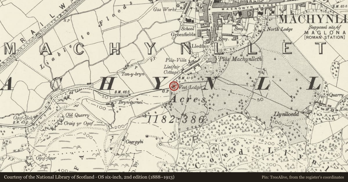
David Rumsey Map Collection, Stanford LibrariesDavid Rumsey Map Collection, Stanford LibrariesDavid Rumsey Map Collection, Stanford LibrariesDavid Rumsey Map Collection, Stanford LibrariesLlyfrgell Genedlaethol Cymru – The National Library of Wales
5 historical maps cover this location, the earliest the 1795 map "To Sir Watkin Williams-Wynn Bart ... the map of the six counties of North Wales is most humbly inscribed by his obedient humble servant" (Llyfrgell Genedlaethol Cymru – The National Library of Wales).
Historical maps covering this location
- 1795 · To Sir Watkin Williams-Wynn Bart ... the map of the six counties of North Wales is most… (Llyfrgell Genedlaethol Cymru – The National Library of Wales)
- 1883 · Watershed map England, Wales 3. (David Rumsey Map Collection, Stanford Libraries)
- 1896 · Sheet 7. Ordnance Survey of England and Wales. (David Rumsey Map Collection, Stanford Libraries)
- 1899 · 149 Barmouth (Hills) (David Rumsey Map Collection, Stanford Libraries)
- 1901 · Sheet 9 and 10. (David Rumsey Map Collection, Stanford Libraries)
Cadw's description
Location
Set back from the main road at the E end of the lay-by; at the SW edge of Plas Machynlleth park.
History
Mid Cl9 Jacobethan.
Exterior
Single storey lodge. Coursed rubble with plinth and other dressings; slate roof with distinctive, stepped and curved Dutch gables and octagonal stone chimney stacks. The two advanced and main gables to N and W, meet at an extruded corner; these and the gables to E and S have broad kneelers (similar in style to other Londonderry buildings in the town centre) and diamond panels with blank shields. The rear (S) gable has leaning chimney stack to apex. 4-pane mullion and transom windows with cornice bands. Lean-to porch at left beyond the park gates. Attached modern garage to W side and modern extension to SE.
Reason for designation
Included for group value with Plas Machynlleth and associated listed items.
Nearby in the register
- Gates and Gatepiers at the SW Entry to Plas Machynlleth ParkDomesticunder 1 mi
- Two Sections of Boundary wall to Plas Machynlleth from the former Coach house and Stable down to theDomesticunder 1 mi
- Former Coach House and Stables to Plas Machynlleth (Plas Kennels)Domesticunder 1 mi
- Section of rubble wall bordering the outer Entrance Courtyard between the former coach house & stablDomesticunder 1 mi
Other entries of the same register within about three miles of this one, by straight line.