Cof Cymru: National Historic Assets of Wales · Wales
Multi-purpose farm building at Cefn Cyfrifol
Cadfarch, Powys, Wales
A Grade II listed building in Aberhosan, Cadfarch, Powys, designated on 27 May 2005.
The record
- Designation
- Listed building, Grade II
- Broad class
- No class recorded
- Date of designation
- 27 May 2005
- Locality
- Aberhosan
- Community
- Cadfarch
- Unitary authority
- Powys
- Country
- Wales
- Coordinates
- 52.54705, -3.76973
- Cadw reference
- 84425
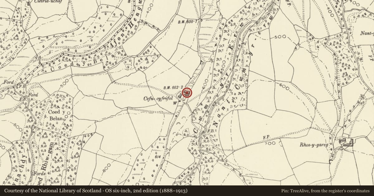
Slide toward Today to fade the historical sheet and see the modern map underneath.
David Rumsey Map Collection, Stanford LibrariesDavid Rumsey Map Collection, Stanford LibrariesDavid Rumsey Map Collection, Stanford LibrariesLlyfrgell Genedlaethol Cymru – The National Library of WalesDavid Rumsey Map Collection, Stanford Libraries
5 historical maps cover this location, the earliest the 1608 map "(13) Cambriae Typus." (David Rumsey Map Collection, Stanford Libraries).
Historical maps covering this location
- 1608 · (13) Cambriae Typus. (David Rumsey Map Collection, Stanford Libraries)
- 1795 · To Sir Watkin Williams-Wynn Bart ... the map of the six counties of North Wales is most… (Llyfrgell Genedlaethol Cymru – The National Library of Wales)
- 1830 · V.3:11-15:XV. Britisches Reich. A. Kon: England. b. Frstenthum Wales: Shire: 37-40 (David Rumsey Map Collection, Stanford Libraries)
- 1883 · Watershed map England, Wales 3. (David Rumsey Map Collection, Stanford Libraries)
- 1901 · Sheet 14. (David Rumsey Map Collection, Stanford Libraries)
Cadw's description
Location
Located opposite the farmhouse, on the E side of the lane.
History
Possibly C17-18 originally as the building retains some timber-framing. It was remodelled in the late C19 with renewed openings, when it included a lofted cart-bay to the W end, and probably a barn towards the centre. The loft above the cart-bay was probably a granary, and a slate tablet over its doorway to the W end reads 'Sir WWW Bart 1890', referring to Sir Watkin Williams Wynne, a big landowner in the area.
Exterior
A long lofted range with gable end bordering the road, constructed of shaley rubble to the S side and W gable end, and weather-boarding to the N side above a high stone plinth, all under an old state roof. Some of the weather-boarding to the N side is in a poor state, revealing timber-framing beneath. To the R of the weather-boarding is a cart-bay, with small window above; to the L, the elevation is obscured by a farm building of c2000. The W gable end has external stone stairs leading to a loft doorway, which has a segmental brick head with keystone and hoodmould, the door itself a chipboard replacement. Above is a square slate tablet inscribed 'Sir WWW bart. 1890' within a border. The S side has 2 doorways, both with segmental brick heads, a centre doorway (with chipboard door), probably the rear winnowing doorway of the barn, and split doors to R. Former loft hatch, infilled with stone, towards L.
Interior
Interior not seen at resurvey.
Reason for designation
Listed as a farm range retaining its historic character, including C19 estate detail, and for group value with the farm-house.
Nearby in the register
- Cefn CyfrifolNo class recordedunder 1 mi
- Cwm-hafod-marchNo class recorded1 mi
- Aberhosan Independent Chapel, including forecourt walls and railingsReligious, Ritual and Funerary1 mi
- Cae CarogNo class recorded1 mi
Other entries of the same register within about three miles of this one, by straight line.