Cof Cymru: National Historic Assets of Wales · Wales
Cwm-hafod-march
Cadfarch, Powys, Wales
A Grade II listed building in Aberhosan, Cadfarch, Powys, designated on 27 May 2005.
The record
- Designation
- Listed building, Grade II
- Broad class
- No class recorded
- Date of designation
- 27 May 2005
- Locality
- Aberhosan
- Community
- Cadfarch
- Unitary authority
- Powys
- Country
- Wales
- Coordinates
- 52.54561, -3.74425
- Cadw reference
- 84421
Slide toward Today to fade the historical sheet and see the modern map underneath.
David Rumsey Map Collection, Stanford LibrariesDavid Rumsey Map Collection, Stanford LibrariesDavid Rumsey Map Collection, Stanford LibrariesLlyfrgell Genedlaethol Cymru – The National Library of WalesDavid Rumsey Map Collection, Stanford Libraries
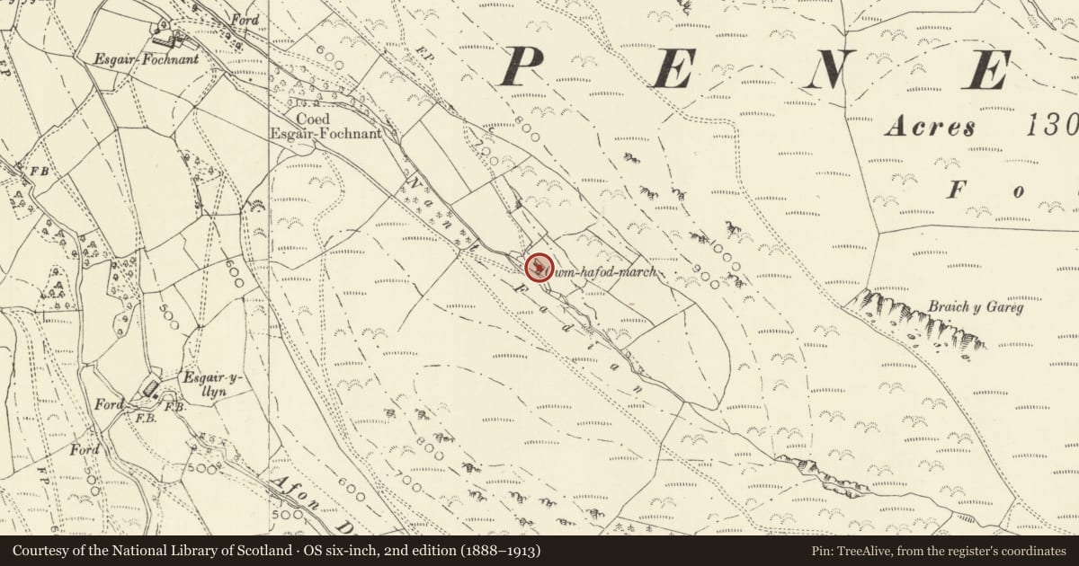
5 historical maps cover this location, the earliest the 1608 map "(13) Cambriae Typus." (David Rumsey Map Collection, Stanford Libraries).
Historical maps covering this location
- 1608 · (13) Cambriae Typus. (David Rumsey Map Collection, Stanford Libraries)
- 1795 · To Sir Watkin Williams-Wynn Bart ... the map of the six counties of North Wales is most… (Llyfrgell Genedlaethol Cymru – The National Library of Wales)
- 1830 · V.3:11-15:XV. Britisches Reich. A. Kon: England. b. Frstenthum Wales: Shire: 37-40 (David Rumsey Map Collection, Stanford Libraries)
- 1883 · Watershed map England, Wales 3. (David Rumsey Map Collection, Stanford Libraries)
- 1901 · Sheet 14. (David Rumsey Map Collection, Stanford Libraries)
Cadw's description
Location
In an upland location approx. 2.3km from Aberhosan, reached by a lane which runs S from the village, and a track.
History
Probably C18 and shown on a 1763 map of Penegoes. The building is shown as a single range on the Tithe map of 1840, suggesting that the front wing is mid-C19. In an upland location and probably a small-holding.
Exterior
A single-storey 2-unit lobby-entry house, with front wing added to R end and adjoining stable to L. The house is of white-washed rubble stone under a slate roof with stone stack to L end. Boarded door with timber lintel to L forming lobby-entrance, 2 x 9-pane windows to R with opening casements, immediately under the eaves. The front wing, possibly a parlour, is single-storey with a lower roof-line, and stone end stack to R; it has a 12-pane hornless sash window to front. Stable adjoining to L has central boarded door; window with slate sill to L, now infilled with metal sheeting; very small light to R. It has been converted to a garage with double boarded doors to W gable end. A shadow on the gable of the house suggests that the stable replaced an earlier outbuilding. Rear is cut into the bank, detail not seen.
Interior
Interior not seen at resurvey.
Reason for designation
Listed as a small upland C18 lobby-entry house and an unusual survival of a single-storeyed dwelling, retaining its character and detail.
Nearby in the register
- Foel Fadian Round BarrowRound Barrowunder 1 mi
- Multi-purpose farm building at Cefn CyfrifolNo class recorded1 mi
- Cefn CyfrifolNo class recorded1 mi
- CaethleNo class recorded1 mi
Other entries of the same register within about three miles of this one, by straight line.