Cof Cymru: National Historic Assets of Wales · Wales
Outbuildings at Pontybat
Felin-Fach, Powys, Wales
A Grade II listed building in Llanfilo, Brecon, Felin-Fach, Powys, designated on 31 March 2005.
The record
- Designation
- Listed building, Grade II
- Broad class
- No class recorded
- Date of designation
- 31 March 2005
- Locality
- Llanfilo
- Town
- Brecon
- Community
- Felin-Fach
- Unitary authority
- Powys
- Country
- Wales
- Coordinates
- 51.99713, -3.29091
- Cadw reference
- 84323
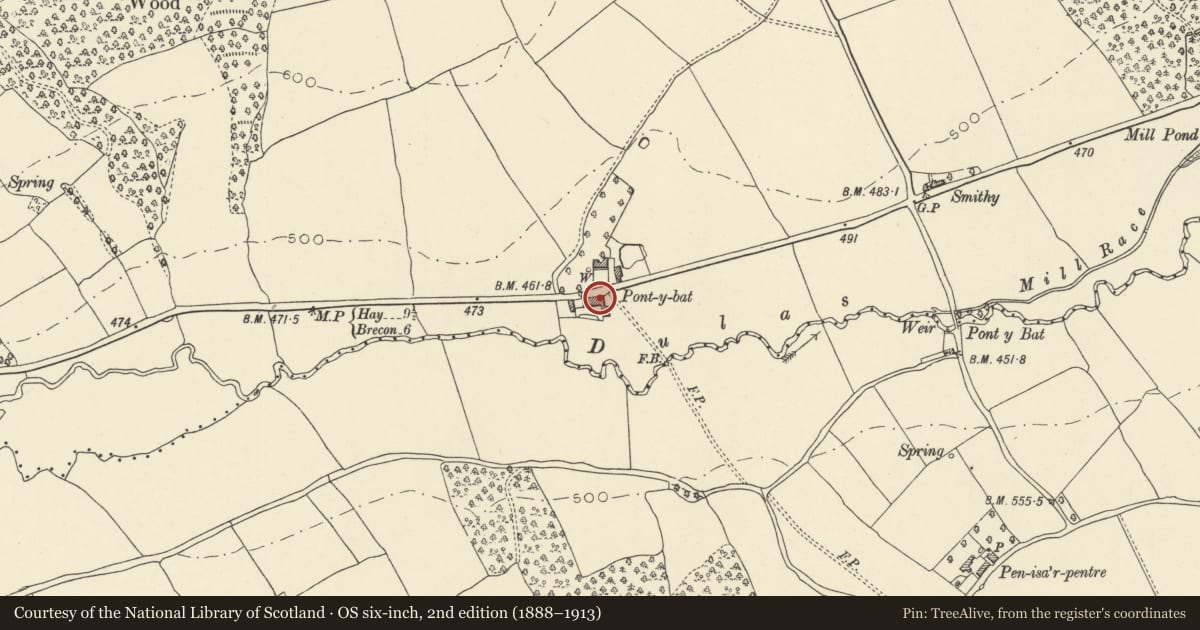
Slide toward Today to fade the historical sheet and see the modern map underneath.
David Rumsey Map Collection, Stanford LibrariesDavid Rumsey Map Collection, Stanford LibrariesDavid Rumsey Map Collection, Stanford LibrariesDavid Rumsey Map Collection, Stanford LibrariesDavid Rumsey Map Collection, Stanford Libraries
5 historical maps cover this location, the earliest the 1608 map "(13) Cambriae Typus." (David Rumsey Map Collection, Stanford Libraries).
Historical maps covering this location
- 1608 · (13) Cambriae Typus. (David Rumsey Map Collection, Stanford Libraries)
- 1636 · Cornubia : Devonia, Somersetus, Dorcestria, Wiltonia, Glocestria ... (David Rumsey Map Collection, Stanford Libraries)
- 1856 · 42. Brecon. (David Rumsey Map Collection, Stanford Libraries)
- 1896 · 214 Talgarth (Hills) (David Rumsey Map Collection, Stanford Libraries)
- 1901 · Sheet 14. (David Rumsey Map Collection, Stanford Libraries)
Cadw's description
Location
On the S side of the A470 opposite the farmhouse at Pontybat.
History
Large group of C18 to C19 barns to Pontybat, which stands on opposite side of main A470 road. In poor condition 2004.
Exterior
Outbuildings, whitewashed rubble stone with slate roofs, hipped at NW angle. L-plan with barn parallel to road, gable-ended to E. N range parallel to road has barn to E with two cross-loops each side of tall door with timber lintel, cross-loop to left has been enlarged to long narrow light. To right is range with five tall open upper bays divided by stone piers, low door to ground floor left with timber lintel. W end has two cambered headed C19 cart-entries with cut stone voussoirs. S side has added stone lean-to.
Range at right angles to E end has E front with slate-lean to to left of damaged full height barn opening, and two rows of two vent-loops to right of straight joint to end of road side range, which has two cross loops. Walls of this range are bowing.
Interior
Not inspected.
Reason for designation
Included for its historic interest as a substantial range of C18/C19 barn buildings of group value with Pontybat.
Nearby in the register
- PontybatDomesticunder 1 mi
- Moated Site E of Pont-y-Bat WoodMoated Siteunder 1 mi
- PendarrenDomesticunder 1 mi
- The Old RectoryDomesticunder 1 mi
Other entries of the same register within about three miles of this one, by straight line.