Cof Cymru: National Historic Assets of Wales · Wales
Oleu Ffynnon
Llangurig, Powys, Wales
A Grade II listed building in Old Hall, Llangurig, Powys, designated on 24 March 2005.
The record
- Designation
- Listed building, Grade II
- Broad class
- No class recorded
- Date of designation
- 24 March 2005
- Locality
- Old Hall
- Community
- Llangurig
- Unitary authority
- Powys
- Country
- Wales
- Coordinates
- 52.44735, -3.58758
- Cadw reference
- 84300
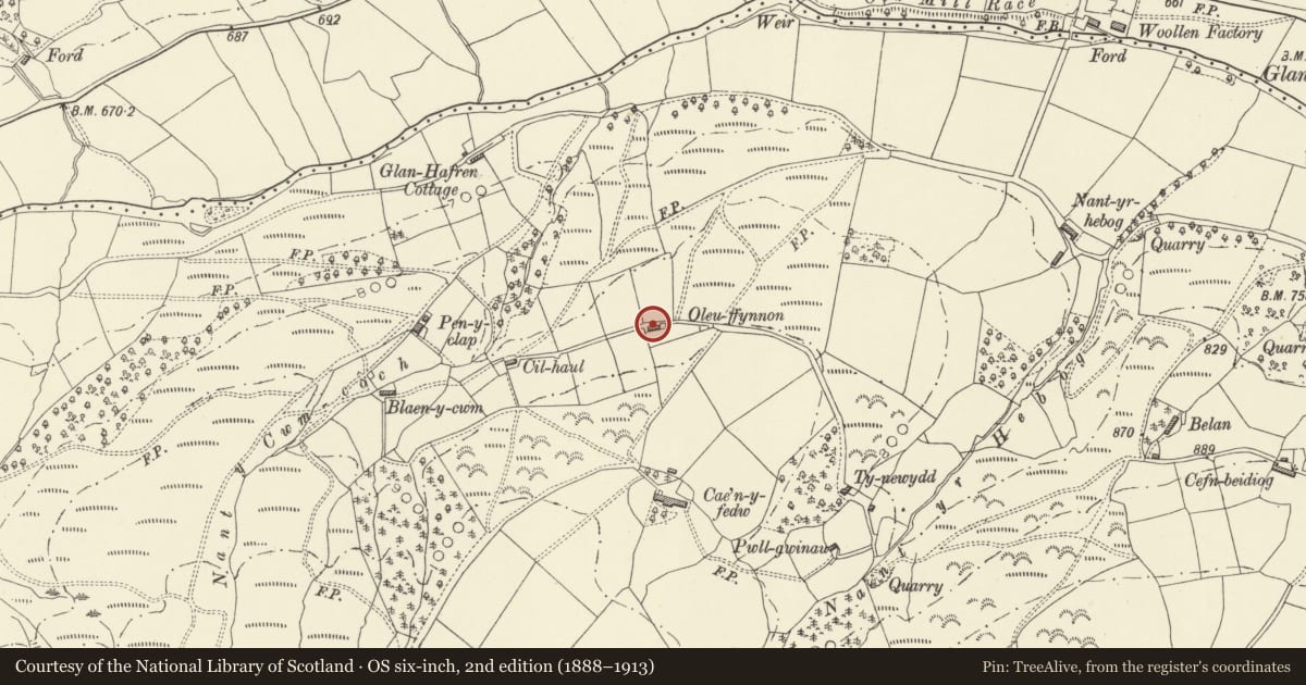
Slide toward Today to fade the historical sheet and see the modern map underneath.
David Rumsey Map Collection, Stanford LibrariesDavid Rumsey Map Collection, Stanford LibrariesDavid Rumsey Map Collection, Stanford LibrariesDavid Rumsey Map Collection, Stanford LibrariesDavid Rumsey Map Collection, Stanford Libraries
5 historical maps cover this location, the earliest the 1608 map "(13) Cambriae Typus." (David Rumsey Map Collection, Stanford Libraries).
Historical maps covering this location
- 1608 · (13) Cambriae Typus. (David Rumsey Map Collection, Stanford Libraries)
- 1637 · Particular description of Wales. Cambria seu Wallia (David Rumsey Map Collection, Stanford Libraries)
- 1883 · Watershed map England, Wales 3. (David Rumsey Map Collection, Stanford Libraries)
- 1899 · 164 Llanidloes (Hills) (David Rumsey Map Collection, Stanford Libraries)
- 1901 · Sheet 14. (David Rumsey Map Collection, Stanford Libraries)
Cadw's description
Location
Located above the S banks of the River Severn, off a lane which runs alongside the river from Felindre to Old Hall. The house is on a track, 0.5km from this lane.
History
Mid-late C19 farmhouse.
Exterior
Symmetrical 2-storey 2-window house with central entrance. Flanking lower wings, that to L probably a service unit, that to R an outbuilding. Rendered and whitewashed on a plinth, under a shallow slate roof, with rebuilt red brick end stacks. Two-light iron-glazed windows with large panes. Shaped hoodmoulds to lower storey openings, the upper storey windows under the eaves. Split doors to centre with flanking windows. The rear, partly seen, has a tall 2-light casement window to centre of upper storey, probably a stairlight, and a late C20 glazed opening below.
The lower units flanking the house both have corrugated metal roofs; that to R is weather-boarded with a boarded door to far L. The L unit is rendered and has boarded door and iron-glazed window both offset to R; similar window aligned above. Its E gable end has split doors offset to R, accessed from an open-fronted garage. The rear is of brick and has a casement window to upper storey, lower storey not seen.
Interior
Interior not seen at resurvey.
Reason for designation
Listed as a small upland farmhouse with attached outbuildings, retaining C19 character and detail.
Nearby in the register
- Cincoed with attached farm buildingsNo class recordedunder 1 mi
- Glyn ClywedogDomestic1 mi
- Stable and Cart-shed at Glyn ClywedogNo class recorded1 mi
- Mount SevernRecreational1 mi
Other entries of the same register within about three miles of this one, by straight line.