Cof Cymru: National Historic Assets of Wales · Wales
Ty Seren
Nantmel, Powys, Wales
A Grade II listed building in Nantmel, Powys, designated on 28 February 2005.
The record
- Designation
- Listed building, Grade II
- Broad class
- No class recorded
- Date of designation
- 28 February 2005
- Locality
- Nantmel
- Community
- Nantmel
- Unitary authority
- Powys
- Country
- Wales
- Coordinates
- 52.28543, -3.42018
- Cadw reference
- 84142
Slide toward Today to fade the historical sheet and see the modern map underneath.
David Rumsey Map Collection, Stanford LibrariesDavid Rumsey Map Collection, Stanford LibrariesDavid Rumsey Map Collection, Stanford LibrariesDavid Rumsey Map Collection, Stanford LibrariesDavid Rumsey Map Collection, Stanford Libraries
5 historical maps cover this location, the earliest the 1608 map "(13) Cambriae Typus." (David Rumsey Map Collection, Stanford Libraries).
Historical maps covering this location
- 1608 · (13) Cambriae Typus. (David Rumsey Map Collection, Stanford Libraries)
- 1637 · Particular description of Wales. Cambria seu Wallia (David Rumsey Map Collection, Stanford Libraries)
- 1883 · Watershed map England, Wales 3. (David Rumsey Map Collection, Stanford Libraries)
- 1898 · 179 Rhyader (Hills) (David Rumsey Map Collection, Stanford Libraries)
- 1901 · Sheet 14. (David Rumsey Map Collection, Stanford Libraries)
Cadw's description
Location
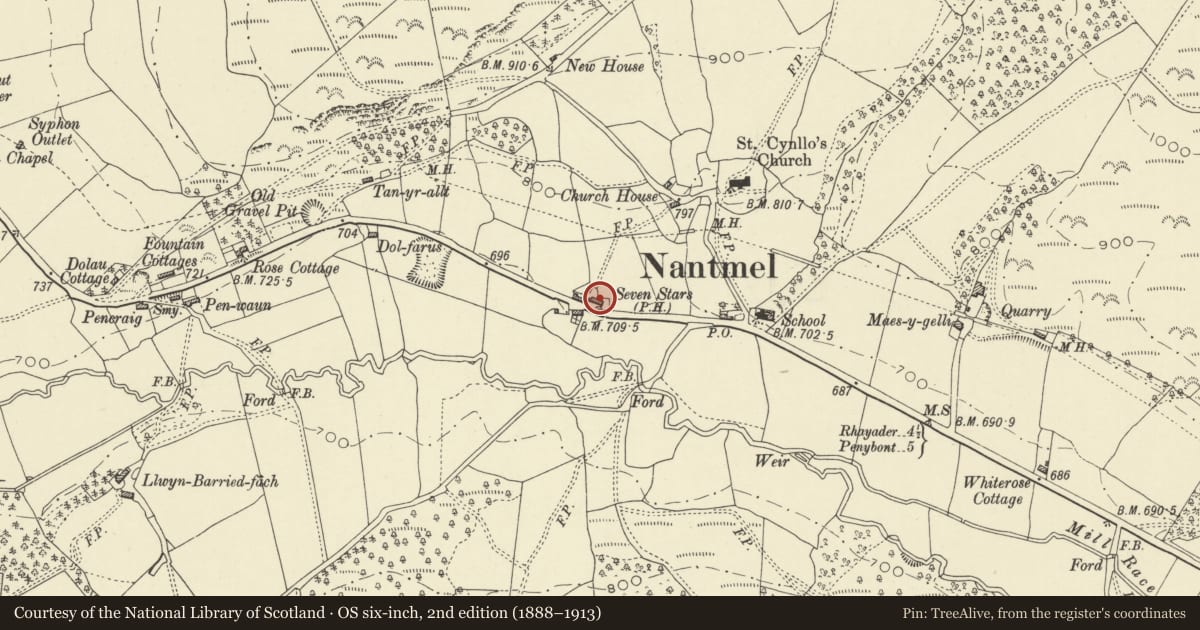
On the N side of the road through the village, approximately 250m SW of the parish church.
History
Originally the Seven Stars public house and shown on the 1840 Tithe map and 1889 Ordnance Survey, although the character of the building suggests a mid C19 date.
Exterior
A 2½-storey 3-window house of whitened rubble-stone walls, slate roof on projecting boarded eaves, and stone end stacks. Openings are offset slightly to the R side, and have stone segmental heads with prominent keystones. The doorway is within a later boarded porch and has an early C20 door with glazed panel. Lower-storey windows are 16-pane hornless sashes. The upper storey has 12-pane hornless sash windows. The L gable end is pebble-dashed and has a replaced attic window to the L side. Set back from the front is a single-storey link to a detached weatherboarded range.
Reason for designation
Listed for its special architectural interest as an early/mid C19 public house retaining original character and detail.
Nearby in the register
- Aqueduct SW of Church of St CynlloNo class recordedunder 1 mi
- Lych gate at Church of St CynlloNo class recordedunder 1 mi
- Church of St CynlloNo class recordedunder 1 mi
- Aqueduct SE of Church of St CynlloNo class recordedunder 1 mi
Other entries of the same register within about three miles of this one, by straight line.