Cof Cymru: National Historic Assets of Wales · Wales
Aqueduct SE of Church of St Cynllo
Nantmel, Powys, Wales
A Grade II listed building in Nantmel, Powys, designated on 28 February 2005.
The record
- Designation
- Listed building, Grade II
- Broad class
- No class recorded
- Date of designation
- 28 February 2005
- Locality
- Nantmel
- Community
- Nantmel
- Unitary authority
- Powys
- Country
- Wales
- Coordinates
- 52.28600, -3.41596
- Cadw reference
- 84101
Slide toward Today to fade the historical sheet and see the modern map underneath.
David Rumsey Map Collection, Stanford LibrariesDavid Rumsey Map Collection, Stanford LibrariesDavid Rumsey Map Collection, Stanford LibrariesDavid Rumsey Map Collection, Stanford LibrariesDavid Rumsey Map Collection, Stanford Libraries
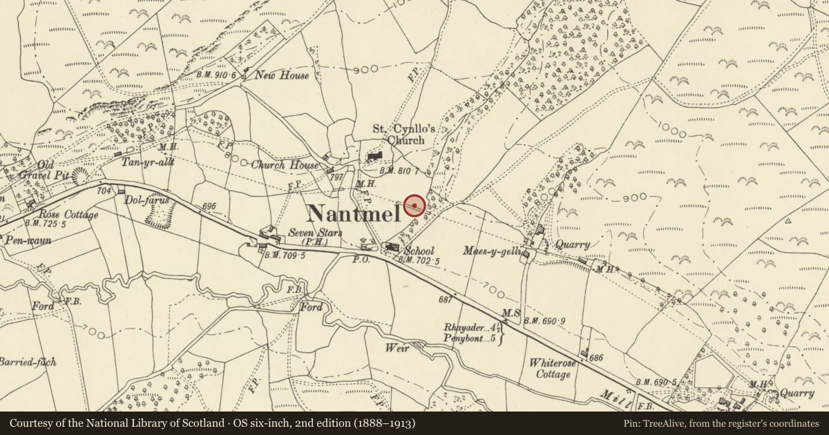
5 historical maps cover this location, the earliest the 1608 map "(13) Cambriae Typus." (David Rumsey Map Collection, Stanford Libraries).
Historical maps covering this location
- 1608 · (13) Cambriae Typus. (David Rumsey Map Collection, Stanford Libraries)
- 1637 · Particular description of Wales. Cambria seu Wallia (David Rumsey Map Collection, Stanford Libraries)
- 1883 · Watershed map England, Wales 3. (David Rumsey Map Collection, Stanford Libraries)
- 1898 · 179 Rhyader (Hills) (David Rumsey Map Collection, Stanford Libraries)
- 1901 · Sheet 14. (David Rumsey Map Collection, Stanford Libraries)
Cadw's description
Location
In a field SE of the churchyard, spanning a steep-sided dingle.
History
Part of the Birmingham Corporation scheme to supply water to the city from reservoirs in the Elan Valley. The project began in 1892 with the construction of the reservoirs and opened in 1904. Chief engineer was James Mansergh, joined and later succeeded as project engineers by his sons Ernest Lawson Mansergh and Walter Leahy Mansergh. The water was conveyed principally by means of a subterranean aqueduct, but where the ground level fell below the hydraulic gradient one of the solutions (as used here) was to build an aqueduct above ground.
Exterior
An 8-span aqueduct carrying a steel conduit across a steep-sided brook. Of coursed rock-faced stone with freestone dressings and quoins. Segmental arches of 20-foot (6.1m) span have prominent keystones. Tapering piers are continued up to the coped parapet as freestone panelled pilasters. A thick band is beneath the parapet. Original iron railings and gates are at the ends. The conduit is buried beneath gravel within the trough of the aqueduct.
Reason for designation
Listed for its special architectural and historic interest as a well-detailed aqueduct of definite quality and character in a prominent location, and as an integral component of one of the foremost civil engineering projects of the early C20 in Wales.
Nearby in the register
- Church of St CynlloNo class recordedunder 1 mi
- Lych gate at Church of St CynlloNo class recordedunder 1 mi
- Aqueduct SW of Church of St CynlloNo class recordedunder 1 mi
- Water conduit at Maes-y-gelli FarmNo class recordedunder 1 mi
Other entries of the same register within about three miles of this one, by straight line.