Cof Cymru: National Historic Assets of Wales · Wales
The White Barn
Maentwrog, Gwynedd, Wales
A Grade II listed building in Tan-y-bwlch, Maentwrog, Gwynedd, designated on 25 February 2005.
The record
- Designation
- Listed building, Grade II
- Broad class
- Commercial
- Date of designation
- 25 February 2005
- Locality
- Tan-y-bwlch
- Community
- Maentwrog
- Unitary authority
- Gwynedd
- Country
- Wales
- Coordinates
- 52.94681, -3.99827
- Cadw reference
- 84024
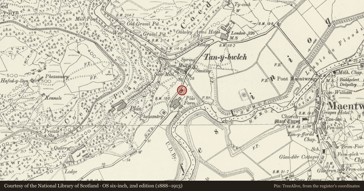
Slide toward Today to fade the historical sheet and see the modern map underneath.
David Rumsey Map Collection, Stanford LibrariesDavid Rumsey Map Collection, Stanford LibrariesDavid Rumsey Map Collection, Stanford LibrariesLlyfrgell Genedlaethol Cymru – The National Library of WalesDavid Rumsey Map Collection, Stanford Libraries
5 historical maps cover this location, the earliest the 1795 map "To Sir Watkin Williams-Wynn Bart ... the map of the six counties of North Wales is most humbly inscribed by his obedient humble servant" (Llyfrgell Genedlaethol Cymru – The National Library of Wales).
Historical maps covering this location
- 1795 · To Sir Watkin Williams-Wynn Bart ... the map of the six counties of North Wales is most… (Llyfrgell Genedlaethol Cymru – The National Library of Wales)
- 1883 · Watershed map England, Wales 3. (David Rumsey Map Collection, Stanford Libraries)
- 1896 · Sheet 7. Ordnance Survey of England and Wales. (David Rumsey Map Collection, Stanford Libraries)
- 1899 · 119 Snowdon (Hills) (David Rumsey Map Collection, Stanford Libraries)
- 1901 · Sheet 9 and 10. (David Rumsey Map Collection, Stanford Libraries)
Cadw's description
Location
In a slightly elevated position, set back from the SE side of the A487(T) in the centre of the small hamlet of Tan-y-bwlch.
History
Late C19 building, possibly built as a dairy for the Tan y bwlch estate, and now a house and restaurant.
Exterior
Single storey, long 6-bay building of roughly coursed mortared rubble masonry. Roof of slates arranged in a decorative pattern, with broadly advanced feathered eaves on monolithic stone piers; rectangular stone stacks with dripcourse and capping. Glazed double doors towards left of front elevation, and 2-light casement windows with shutters. Similar detail to rear.
At R (SW) gable there is a modern, flat roofed addition and there is a timber walled addition under the eaves to rear.
Interior
The interior was not inspected at the time of the survey (June/July 2003).
Reason for designation
Listed notwithstanding alteration as a building of unusual form and strange architectural character, strongly linked to the Tan-y-bwlch estate.
Nearby in the register
- Hay Barn adjacent to Yr Hen Ysgubor and Crochendy TwrogAgriculture and Subsistenceunder 1 mi
- Yr Hen Ysgubor aka Barton LodgeDomesticunder 1 mi
- Crochendy TwrogCommercialunder 1 mi
- Ty'r FelinAgriculture and Subsistenceunder 1 mi
Other entries of the same register within about three miles of this one, by straight line.