Cof Cymru: National Historic Assets of Wales · Wales
Yr Hen Ysgubor aka Barton Lodge
Maentwrog, Gwynedd, Wales
A Grade II listed building in Tan-y-Bwlch, Blaenau Ffestiniog, Maentwrog, Gwynedd, designated on 24 January 2001.
The record
- Designation
- Listed building, Grade II
- Broad class
- Domestic
- Date of designation
- 24 January 2001
- Locality
- Tan-y-Bwlch
- Town
- Blaenau Ffestiniog
- Community
- Maentwrog
- Unitary authority
- Gwynedd
- Country
- Wales
- Coordinates
- 52.94629, -3.99892
- Cadw reference
- 24536
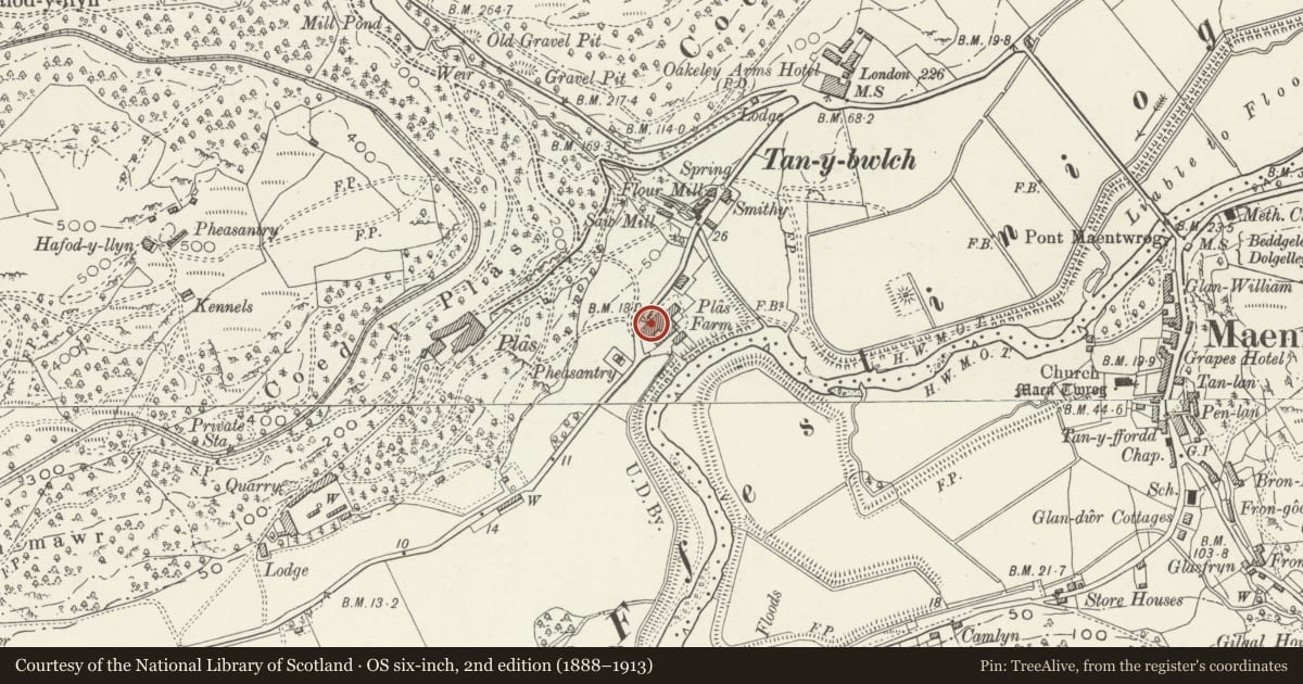
Slide toward Today to fade the historical sheet and see the modern map underneath.
David Rumsey Map Collection, Stanford LibrariesDavid Rumsey Map Collection, Stanford LibrariesDavid Rumsey Map Collection, Stanford LibrariesLlyfrgell Genedlaethol Cymru – The National Library of WalesDavid Rumsey Map Collection, Stanford Libraries
5 historical maps cover this location, the earliest the 1795 map "To Sir Watkin Williams-Wynn Bart ... the map of the six counties of North Wales is most humbly inscribed by his obedient humble servant" (Llyfrgell Genedlaethol Cymru – The National Library of Wales).
Historical maps covering this location
- 1795 · To Sir Watkin Williams-Wynn Bart ... the map of the six counties of North Wales is most… (Llyfrgell Genedlaethol Cymru – The National Library of Wales)
- 1883 · Watershed map England, Wales 3. (David Rumsey Map Collection, Stanford Libraries)
- 1896 · Sheet 7. Ordnance Survey of England and Wales. (David Rumsey Map Collection, Stanford Libraries)
- 1899 · 119 Snowdon (Hills) (David Rumsey Map Collection, Stanford Libraries)
- 1901 · Sheet 9 and 10. (David Rumsey Map Collection, Stanford Libraries)
Cadw's description
Location
On S side of A487, about 250m SW of junction with B 4410, aligned with road, but at a lower level.
History
Formerly mill/workshop, water-powered by pelton wheel. Formed part of Mid C19 model farmstead of Plas Tan-y-Bwlch Estate, but probably has earlier origins.
Exterior
Brown stone with slate roof. North elevation has, from L, 2 small windows, and large doorway; to R, steps up to smaller doorway (modern box dormer in roofslope above this); at R corner, large rectangular chimney. Right return has round window in gable, bridge to doorway and window at upper level, further doorways and windows at ground level.
Reason for designation
Included as part of a good group of model farm buildings. Group value with Crochendy Twrog and the Hay Barn.
Nearby in the register
- Crochendy TwrogCommercialunder 1 mi
- Hay Barn adjacent to Yr Hen Ysgubor and Crochendy TwrogAgriculture and Subsistenceunder 1 mi
- The White BarnCommercialunder 1 mi
- Ty'r FelinAgriculture and Subsistenceunder 1 mi
Other entries of the same register within about three miles of this one, by straight line.