Cof Cymru: National Historic Assets of Wales · Wales
Former servant's quarters to rear of Plas Tan-y-bwlch
Maentwrog, Gwynedd, Wales
A Grade II listed building in Tan-y-bwlch, Maentwrog, Gwynedd, designated on 25 February 2005.
The record
- Designation
- Listed building, Grade II
- Broad class
- No class recorded
- Date of designation
- 25 February 2005
- Locality
- Tan-y-bwlch
- Community
- Maentwrog
- Unitary authority
- Gwynedd
- Country
- Wales
- Coordinates
- 52.94625, -4.00279
- Cadw reference
- 84001
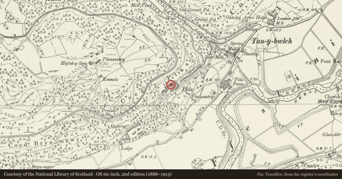
Slide toward Today to fade the historical sheet and see the modern map underneath.
David Rumsey Map Collection, Stanford LibrariesDavid Rumsey Map Collection, Stanford LibrariesDavid Rumsey Map Collection, Stanford LibrariesLlyfrgell Genedlaethol Cymru – The National Library of WalesDavid Rumsey Map Collection, Stanford Libraries
5 historical maps cover this location, the earliest the 1795 map "To Sir Watkin Williams-Wynn Bart ... the map of the six counties of North Wales is most humbly inscribed by his obedient humble servant" (Llyfrgell Genedlaethol Cymru – The National Library of Wales).
Historical maps covering this location
- 1795 · To Sir Watkin Williams-Wynn Bart ... the map of the six counties of North Wales is most… (Llyfrgell Genedlaethol Cymru – The National Library of Wales)
- 1883 · Watershed map England, Wales 3. (David Rumsey Map Collection, Stanford Libraries)
- 1896 · Sheet 7. Ordnance Survey of England and Wales. (David Rumsey Map Collection, Stanford Libraries)
- 1899 · 119 Snowdon (Hills) (David Rumsey Map Collection, Stanford Libraries)
- 1901 · Sheet 9 and 10. (David Rumsey Map Collection, Stanford Libraries)
Cadw's description
Location
In an elevated location, set within private grounds above the NW side of the A487(T) on the W approach to the village of Maentwrog. The servant's quarters are to rear (NW) of the main house at Plas Tan-y-bwlch.
History
Probably late C18 or early C19 wing, altered and extended in later C19 and C20.
Exterior
Across the rear yard behind the house, and set at a slight angle to the entrance gatehouse, is the rear wing, including the 3-storey former servants quarters. The 3-storey block is a 5-window range built of coursed local stone; embattled parapet and shaped dripcourse round the upper storey and across the front (S) elevation above the 1st floor windows. Shallow pitched slate roof with stone copings and rectangular gable stacks. There is a doorway offset to R under a shallow overlight with glazing bars, another doorway at far L and a partially blocked doorway to R of the later cut at L end with window in the upper part; windows are timber casements of 2-lights.
Slightly recessed from the R end is a late C19 gabled, 2-storey, 6-window range abutting the NW corner of the gatehouse. There is a modern doorway to the L end of the range and slightly recessed 4-pane casement windows with slate sills. To L end of the 3-storey block is a modern single storey wing, faced with stone and with a shallow slate gable roof; modern door and windows along the range.
Reason for designation
Included as a service range that is an integral part of the ensemble of buildings at Plas Tan-y-bwlch.
Nearby in the register
- Plas Tan-y-Bwlch including attached terrace walls to east and westEducationunder 1 mi
- Former coach house and stable range at Plas Tan-y-bwlchEducationunder 1 mi
- Garden Terrace to S and E of Plas Tan y bwlchDomesticunder 1 mi
- Yr Hen Ysgubor aka Barton LodgeDomesticunder 1 mi
Other entries of the same register within about three miles of this one, by straight line.