Cof Cymru: National Historic Assets of Wales · Wales
Navron
Llantwit Major, Vale of Glamorgan, Wales
A Grade II listed building in Boverton, Cowbridge / Y Bont-Faen, Llantwit Major, Vale of Glamorgan, designated on 10 September 1982.
The record
- Designation
- Listed building, Grade II
- Broad class
- Domestic
- Date of designation
- 10 September 1982
- Locality
- Boverton
- Town
- Cowbridge / Y Bont-Faen
- Community
- Llantwit Major
- Unitary authority
- Vale of Glamorgan
- Country
- Wales
- Coordinates
- 51.40584, -3.46363
- Cadw reference
- 83395
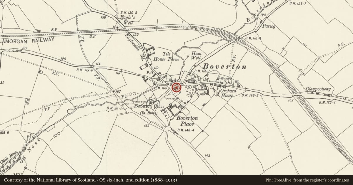
Slide toward Today to fade the historical sheet and see the modern map underneath.
David Rumsey Map Collection, Stanford LibrariesDavid Rumsey Map Collection, Stanford LibrariesDavid Rumsey Map Collection, Stanford LibrariesDavid Rumsey Map Collection, Stanford LibrariesDavid Rumsey Map Collection, Stanford Libraries
5 historical maps cover this location, the earliest the 1636 map "Cornubia : Devonia, Somersetus, Dorcestria, Wiltonia, Glocestria ..." (David Rumsey Map Collection, Stanford Libraries).
Historical maps covering this location
- 1636 · Cornubia : Devonia, Somersetus, Dorcestria, Wiltonia, Glocestria ... (David Rumsey Map Collection, Stanford Libraries)
- 1858 · 20. Bridgewater. (David Rumsey Map Collection, Stanford Libraries)
- 1865 · England and Wales. England No. 6. (David Rumsey Map Collection, Stanford Libraries)
- 1897 · 262 Pontypridd (Hills) (David Rumsey Map Collection, Stanford Libraries)
- 1897 · 262 Pontypridd (Outline) (David Rumsey Map Collection, Stanford Libraries)
Cadw's description
Location
Adjoins The Causeway on the east.
History
A late C18 or early C19 addition to the C16 The Causeway. Although the features have been replaced the house has not really been changed in appearance. This house appears to be shown on the 1840 Tithe map.
Exterior
Roughcast cladding to stone walls with smooth stuccoed architraves and end narrow pilaster bands. Welsh slate gabled roof with stone stack to left gable. Two storeys, two windows wide. On ground floor, sash window three panes wide to left hand and 4-panelled door with overlight to right hand; two pivot windows, each three panes wide, on first floor. Rear elevation not seen.
Interior
Interior not inspected at resurvey.
Reason for designation
Included as a late C18 house which, despite some alteration, retains special character and has group value with the adjoining The Causeway.
Nearby in the register
- The CausewayDomesticunder 1 mi
- Walls surrounding Garden to west of Boverton HouseDomesticunder 1 mi
- Wall and Gateway opposite Boverton HouseDefenceunder 1 mi
- Garden Walls and Railings of Boverton HouseDomesticunder 1 mi
Other entries of the same register within about three miles of this one, by straight line.