Cof Cymru: National Historic Assets of Wales · Wales
Garden Walls and Railings of Boverton House
Llantwit Major, Vale of Glamorgan, Wales
A Grade II listed building in Boverton, Cowbridge / Y Bont-Faen, Llantwit Major, Vale of Glamorgan, designated on 16 December 2004.
The record
- Designation
- Listed building, Grade II
- Broad class
- Domestic
- Date of designation
- 16 December 2004
- Locality
- Boverton
- Town
- Cowbridge / Y Bont-Faen
- Community
- Llantwit Major
- Unitary authority
- Vale of Glamorgan
- Country
- Wales
- Coordinates
- 51.40601, -3.46260
- Cadw reference
- 83393
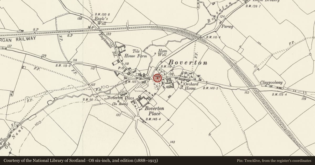
Slide toward Today to fade the historical sheet and see the modern map underneath.
David Rumsey Map Collection, Stanford LibrariesDavid Rumsey Map Collection, Stanford LibrariesDavid Rumsey Map Collection, Stanford LibrariesDavid Rumsey Map Collection, Stanford LibrariesDavid Rumsey Map Collection, Stanford Libraries
5 historical maps cover this location, the earliest the 1636 map "Cornubia : Devonia, Somersetus, Dorcestria, Wiltonia, Glocestria ..." (David Rumsey Map Collection, Stanford Libraries).
Historical maps covering this location
- 1636 · Cornubia : Devonia, Somersetus, Dorcestria, Wiltonia, Glocestria ... (David Rumsey Map Collection, Stanford Libraries)
- 1858 · 20. Bridgewater. (David Rumsey Map Collection, Stanford Libraries)
- 1865 · England and Wales. England No. 6. (David Rumsey Map Collection, Stanford Libraries)
- 1897 · 262 Pontypridd (Hills) (David Rumsey Map Collection, Stanford Libraries)
- 1897 · 262 Pontypridd (Outline) (David Rumsey Map Collection, Stanford Libraries)
Cadw's description
Location
Surrounding the street front and sides of Boverton House.
History
The present appearance is probably from the later C19 when the house was refurbished, but some of the walling is probably C18.
Exterior
Iron railings and gate separate the garden from the outbuilding forecourt. Front garden enclosed from road by limestone rubble walls; centre gate piers with iron overthrow; to east of gate piers, garden wall surmounted by C19 iron railings with finials which rise alternately above top and middle rails. To west of gate piers, a higher wall with ornamental parapet. The upper part of this wall is late C19 as are the railings, gatepiers and gates.
Reason for designation
Included for their group value with Boverton House.
Nearby in the register
- Wall and Gateway opposite Boverton HouseDefenceunder 1 mi
- Boverton House with attached Stable RangeDomesticunder 1 mi
- Walls surrounding Garden to west of Boverton HouseDomesticunder 1 mi
- Cherry Tree CottageDomesticunder 1 mi
Other entries of the same register within about three miles of this one, by straight line.