Cof Cymru: National Historic Assets of Wales · Wales
Penybont
Blaenrheidol, Ceredigion, Wales
A Grade II listed building in Ponterwyd, Aberystwyth, Blaenrheidol, Ceredigion, designated on 25 November 2004.
The record
- Designation
- Listed building, Grade II
- Broad class
- Domestic
- Date of designation
- 25 November 2004
- Locality
- Ponterwyd
- Town
- Aberystwyth
- Community
- Blaenrheidol
- Unitary authority
- Ceredigion
- Country
- Wales
- Coordinates
- 52.41136, -3.84244
- Cadw reference
- 83341
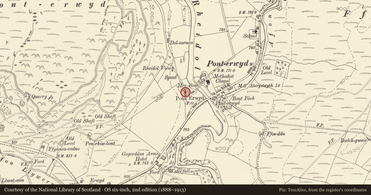
Slide toward Today to fade the historical sheet and see the modern map underneath.
David Rumsey Map Collection, Stanford LibrariesDavid Rumsey Map Collection, Stanford LibrariesDavid Rumsey Map Collection, Stanford LibrariesDavid Rumsey Map Collection, Stanford LibrariesDavid Rumsey Map Collection, Stanford Libraries
5 historical maps cover this location, the earliest the 1608 map "(13) Cambriae Typus." (David Rumsey Map Collection, Stanford Libraries).
Historical maps covering this location
- 1608 · (13) Cambriae Typus. (David Rumsey Map Collection, Stanford Libraries)
- 1830 · V.3:11-15:XV. Britisches Reich. A. Kon: England. b. Frstenthum Wales: Shire: 37-40 (David Rumsey Map Collection, Stanford Libraries)
- 1883 · Watershed map England, Wales 3. (David Rumsey Map Collection, Stanford Libraries)
- 1899 · 163 Aberystwyth (Hills) (David Rumsey Map Collection, Stanford Libraries)
- 1901 · Sheet 14. (David Rumsey Map Collection, Stanford Libraries)
Cadw's description
Location
Situated about 60m W of the old bridge in Ponterwyd, on W side of lane to Dinas reservoir.
History
Mid C19 village house, not marked on 1845 Tithe map, marked on 1891 OS.
Exterior
House, rubble stone with slate roof and three stone chimneys in vernacular Georgian style. Two storeys, long range running down slope, three-bay house to right and two-bay service range uphill to left, under single roof. Windows have brick heads painted alternate red and white, with slate sills set immediately over heads of lower openings. House has hornless 12-pane sashes and centre door with overlight, service range has shorter 9-pane sashes over door and 12-pane, the heads higher than those of main house, due to slope. Roughcast right end wall over attached painted rendered outbuilding possibly a small cowhouse or stable, with door to extreme left and C20 window.
Interior
Interior not available for inspection.
Reason for designation
Included as a little altered traditional house with in-line service range, a characteristic Ceredigion type.
Nearby in the register
- Yr Hen BontTransportunder 1 mi
- Hen Bont, Pont-ErwydBridgeunder 1 mi
- Ponterwyd Calvinistic Methodist Chapel and attached chapel houseReligious, Ritual and Funeraryunder 1 mi
- Former chapel schoolroomReligious, Ritual and Funeraryunder 1 mi
Other entries of the same register within about three miles of this one, by straight line.