Cof Cymru: National Historic Assets of Wales · Wales
Former chapel schoolroom
Blaenrheidol, Ceredigion, Wales
A Grade II listed building in Ponterwyd, Aberystwyth, Blaenrheidol, Ceredigion, designated on 25 November 2004.
The record
- Designation
- Listed building, Grade II
- Broad class
- Religious, Ritual and Funerary
- Date of designation
- 25 November 2004
- Locality
- Ponterwyd
- Town
- Aberystwyth
- Community
- Blaenrheidol
- Unitary authority
- Ceredigion
- Country
- Wales
- Coordinates
- 52.41131, -3.84048
- Cadw reference
- 83331
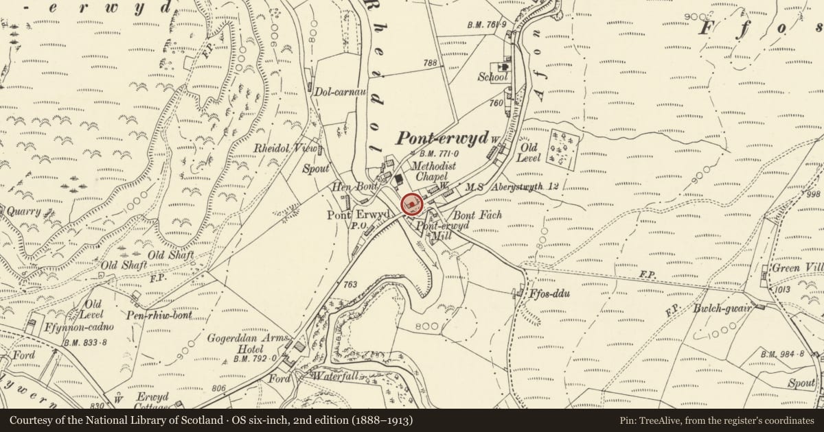
Slide toward Today to fade the historical sheet and see the modern map underneath.
David Rumsey Map Collection, Stanford LibrariesDavid Rumsey Map Collection, Stanford LibrariesDavid Rumsey Map Collection, Stanford LibrariesDavid Rumsey Map Collection, Stanford LibrariesDavid Rumsey Map Collection, Stanford Libraries
5 historical maps cover this location, the earliest the 1608 map "(13) Cambriae Typus." (David Rumsey Map Collection, Stanford Libraries).
Historical maps covering this location
- 1608 · (13) Cambriae Typus. (David Rumsey Map Collection, Stanford Libraries)
- 1830 · V.3:11-15:XV. Britisches Reich. A. Kon: England. b. Frstenthum Wales: Shire: 37-40 (David Rumsey Map Collection, Stanford Libraries)
- 1883 · Watershed map England, Wales 3. (David Rumsey Map Collection, Stanford Libraries)
- 1899 · 163 Aberystwyth (Hills) (David Rumsey Map Collection, Stanford Libraries)
- 1901 · Sheet 14. (David Rumsey Map Collection, Stanford Libraries)
Cadw's description
Location
Situated on N side of A44, on corner of lane running up E side of Rheidol to Ponterwyd Chapel.
History
Schoolroom, now chapel hall, built 1860 as British School for Ponterwyd Methodist chapel.
Exterior
Former school, now hall, rubble stone with slate eaves roof. Single storey with three arched windows on S side, to main road, and W end rubble stone gabled porch. S side windows have stone voussoirs, slate sills and small-paned tracery with Georgian Gothic-style intersecting bars in head. Porch has board door and overlight. W gable has arched recess with stone voussoirs for missing plaque. Roof overhangs at gables with C20 verge boards, similar boards to porch.
Interior
Interior not available for inspection.
Reason for designation
Included as a small schoolroom in late Georgian style, a good example of the nonconformist schools that preceded the Board Schools of the 1870s.
Nearby in the register
- Ponterwyd Calvinistic Methodist Chapel and attached chapel houseReligious, Ritual and Funeraryunder 1 mi
- Yr Hen BontTransportunder 1 mi
- Hen Bont, Pont-ErwydBridgeunder 1 mi
- Milestone on A44 in PonterwydTransportunder 1 mi
Other entries of the same register within about three miles of this one, by straight line.