Cof Cymru: National Historic Assets of Wales · Wales
Long Bridge
Llanidloes, Powys, Wales
A Grade II listed building in Llanidloes, Powys, designated on 10 April 1989.
The record
- Designation
- Listed building, Grade II
- Broad class
- Transport
- Date of designation
- 10 April 1989
- Community
- Llanidloes
- Unitary authority
- Powys
- Country
- Wales
- Coordinates
- 52.45105, -3.53925
- Cadw reference
- 8327
Slide toward Today to fade the historical sheet and see the modern map underneath.
David Rumsey Map Collection, Stanford LibrariesDavid Rumsey Map Collection, Stanford LibrariesDavid Rumsey Map Collection, Stanford LibrariesDavid Rumsey Map Collection, Stanford LibrariesDavid Rumsey Map Collection, Stanford Libraries
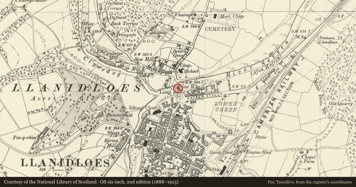
5 historical maps cover this location, the earliest the 1608 map "(13) Cambriae Typus." (David Rumsey Map Collection, Stanford Libraries).
Historical maps covering this location
- 1608 · (13) Cambriae Typus. (David Rumsey Map Collection, Stanford Libraries)
- 1637 · Particular description of Wales. Cambria seu Wallia (David Rumsey Map Collection, Stanford Libraries)
- 1883 · Watershed map England, Wales 3. (David Rumsey Map Collection, Stanford Libraries)
- 1899 · 164 Llanidloes (Hills) (David Rumsey Map Collection, Stanford Libraries)
- 1901 · Sheet 14. (David Rumsey Map Collection, Stanford Libraries)
Cadw's description
Location
Spanning the confluence of the rivers Clywedog and Severn at the end of the town.
History
Built in 1826 by Thomas Penson and widened in 1938 on the upsteam side. Prior to this the timber Long Bridge (built 1741) was sited close to Frankwell. Cost ú3,000.
Exterior
3-arched gently ramped bridge of coursed rubble masonry. Segmental arches and band course over. Low rubble cutwaters to upsteam side. Rubble soffit to older part, concrete to modern part. Parapets and pedestrian pavements are contemporary with widening; inscribed tablets to both parapets. Stepped out at each end are terminating piers. On the S bank, W side the parapet continues slightly ramped and then steps up and sweeps around the corner to terminate at the start of the footpath at the end of Long Bridge Street. On the E side the line of the Old Bridge curves outwards with rubble wall continuing beyond a pier, ramping down towards the pavement. On the N bank the listing stops at the end of the bridge on W side and on the E side the line of the old bridge curves out slightly to end in a pier at the road along the bank.
Nearby in the register
- Frankwell HouseDomesticunder 1 mi
- Frankwell CottageDomesticunder 1 mi
- Former English Wesleyan chapelReligious, Ritual and Funeraryunder 1 mi
- 22 Long Bridge StreetDomesticunder 1 mi
Other entries of the same register within about three miles of this one, by straight line.