Cof Cymru: National Historic Assets of Wales · Wales
The Castle Hotel
Maenclochog, Pembrokeshire, Wales
A Grade II listed building in Maenclochog, Clynderwen, Pembrokeshire, designated on 15 October 2004.
The record
- Designation
- Listed building, Grade II
- Broad class
- Commercial
- Date of designation
- 15 October 2004
- Locality
- Maenclochog
- Town
- Clynderwen
- Community
- Maenclochog
- Unitary authority
- Pembrokeshire
- Country
- Wales
- Coordinates
- 51.91133, -4.78770
- Cadw reference
- 83190
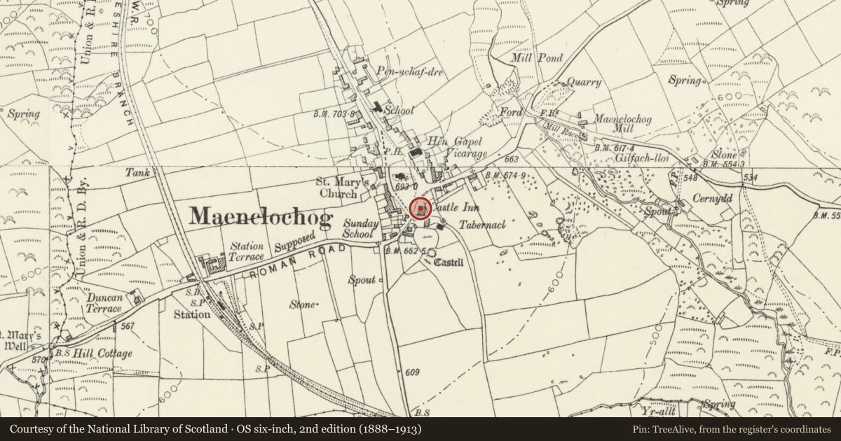
Slide toward Today to fade the historical sheet and see the modern map underneath.
David Rumsey Map Collection, Stanford LibrariesDavid Rumsey Map Collection, Stanford LibrariesDavid Rumsey Map Collection, Stanford LibrariesDavid Rumsey Map Collection, Stanford LibrariesDavid Rumsey Map Collection, Stanford Libraries
5 historical maps cover this location, the earliest the 1636 map "Cornubia : Devonia, Somersetus, Dorcestria, Wiltonia, Glocestria ..." (David Rumsey Map Collection, Stanford Libraries).
Historical maps covering this location
- 1636 · Cornubia : Devonia, Somersetus, Dorcestria, Wiltonia, Glocestria ... (David Rumsey Map Collection, Stanford Libraries)
- 1891 · Sheet 10. Ordnance Survey of England and Wales. . (David Rumsey Map Collection, Stanford Libraries)
- 1898 · 210 Cardigan (Hills) (David Rumsey Map Collection, Stanford Libraries)
- 1898 · 210 Cardigan (Outline) (David Rumsey Map Collection, Stanford Libraries)
- 1901 · Sheet 13. (David Rumsey Map Collection, Stanford Libraries)
Cadw's description
Location
On the SE side of the village green in the centre of Maenclochog.
History
Inn, probably mid C19, the rear range included a shop and pharmacy. A c. 1912 photograph show it little altered except that there was apparently a milliners shop within and a corrugated-iron grocery shop in a lean-to on the N end. A wooden sign board read 'Castle Hotel J. W. Thomas'.
Exterior
Inn, large scale, whitewashed slate-hung front range and roughcast rear, with slate roofs and stone end stacks. Two storeys. Front three-window range of 12-pane sashes with slate sills, no door. Some brick exposed at window edges. Slate-hanging ends just below ground floor sills, render below and rendered plinth. Left end has similar whitewashed slate-hanging and one window each floor set to left. Right end of rubble stone, painted.
Long rear wing is roughcast, of four bays with ridge chimney to left of first bay and left end chimney. Similar horned sashes, in brick surrounds visible where roughcast is eroded. Four upper windows, ground floor has windows in second and third bays, house door with overlight in fourth bay, and shop in first bay. Shop has 30-pane fixed shop window and half-glazed door to left, with overlight. N end has 12-pane sash each floor and smaller window each floor to left, in end of rear outshut.
Interior
Not inspected.
Reason for designation
Included for its special architectural interest as a large scale rural inn with slate-hung walls, a regional feature now rare.
Nearby in the register
- Inscribed Stones outside Ruined Church of St Teilo (now in Maenclochog Church).Cross-marked stoneunder 1 mi
- Church of Saint MaryReligious, Ritual and Funeraryunder 1 mi
- Standing Stone 300m WNW of CilmoorStanding Stoneunder 1 mi
- Galchen-Fach StoneStanding Stoneunder 1 mi
Other entries of the same register within about three miles of this one, by straight line.