Cof Cymru: National Historic Assets of Wales · Wales
Pont Llwyn-dwfr (partly in Clynderwen Community rec no 82471)
Maenclochog, Pembrokeshire, Wales
A Grade II listed building in Llanycefn, Clynderwen, Maenclochog, Pembrokeshire, designated on 15 October 2004.
The record
- Designation
- Listed building, Grade II
- Broad class
- Transport
- Date of designation
- 15 October 2004
- Locality
- Llanycefn
- Town
- Clynderwen
- Community
- Maenclochog
- Unitary authority
- Pembrokeshire
- Country
- Wales
- Coordinates
- 51.87638, -4.75280
- Cadw reference
- 83188
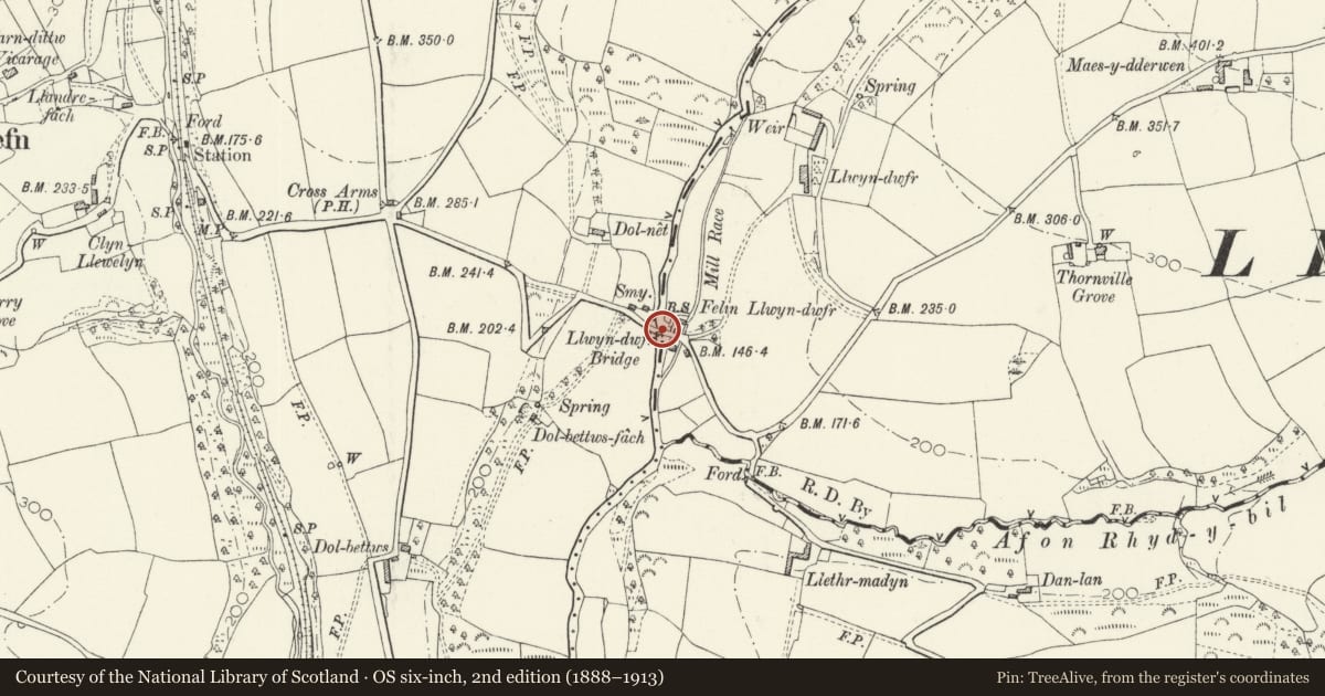
Slide toward Today to fade the historical sheet and see the modern map underneath.
David Rumsey Map Collection, Stanford LibrariesDavid Rumsey Map Collection, Stanford LibrariesDavid Rumsey Map Collection, Stanford LibrariesDavid Rumsey Map Collection, Stanford LibrariesDavid Rumsey Map Collection, Stanford Libraries
5 historical maps cover this location, the earliest the 1636 map "Cornubia : Devonia, Somersetus, Dorcestria, Wiltonia, Glocestria ..." (David Rumsey Map Collection, Stanford Libraries).
Historical maps covering this location
- 1636 · Cornubia : Devonia, Somersetus, Dorcestria, Wiltonia, Glocestria ... (David Rumsey Map Collection, Stanford Libraries)
- 1891 · Sheet 10. Ordnance Survey of England and Wales. . (David Rumsey Map Collection, Stanford Libraries)
- 1898 · 210 Cardigan (Hills) (David Rumsey Map Collection, Stanford Libraries)
- 1898 · 210 Cardigan (Outline) (David Rumsey Map Collection, Stanford Libraries)
- 1901 · Sheet 13. (David Rumsey Map Collection, Stanford Libraries)
Cadw's description
Location
Crossing the Eastern Cleddau some 1km E of the church at Llanycefn.
History
Road bridge over the Eastern Cleddau, probably late C18 / early C19, with county boundary stone. Said to have a C18 datestone on the NW side now obscured by a garden.
Exterior
Bridge, rubble stone, two-arched with recessed arches, stone voussoirs and raised keystones. Cutwater each side of squared slaty stone blocks, with cap and pyramid top. Rubble parapets with long stones intermittently set vertically. On N parapet a boundary stone with inscription in border with rebated corners: left side reads 'Llandykeven (with pointing hand below) Boundary Pembrokeshire', right side has 'Llandissilio Boundary Carmarthenshire'.
Reason for designation
Included for its special interest as a two-arched road bridge with early C19 county boundary stone.
Nearby in the register
- Pont Llwyn Dwfr, including boundary stone (Partly in Maenclochog Community)No class recordedunder 1 mi
- Llwyn DwfrNo class recordedunder 1 mi
- Rhiwiau Round BarrowRound Barrowunder 1 mi
- Nant-y-Cwm Steiner KindergartenEducationunder 1 mi
Other entries of the same register within about three miles of this one, by straight line.