Cof Cymru: National Historic Assets of Wales · Wales
Llwyn Dwfr
Clynderwen, Pembrokeshire, Wales
A Grade II listed building in Llwyn Dwfr, Clynderwen, Pembrokeshire, designated on 10 April 2004.
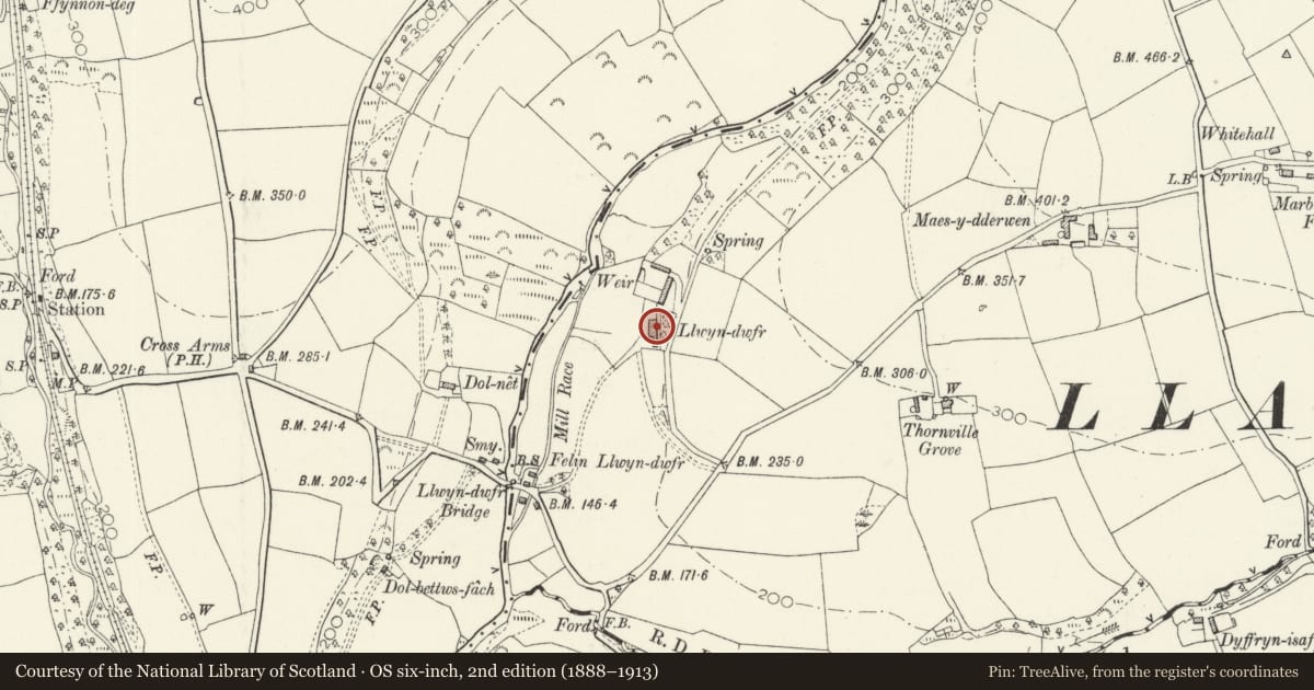
The record
- Designation
- Listed building, Grade II
- Broad class
- No class recorded
- Date of designation
- 10 April 2004
- Locality
- Llwyn Dwfr
- Community
- Clynderwen
- Unitary authority
- Pembrokeshire
- Country
- Wales
- Coordinates
- 51.87826, -4.74998
- Cadw reference
- 82468
Slide toward Today to fade the historical sheet and see the modern map underneath.
David Rumsey Map Collection, Stanford LibrariesDavid Rumsey Map Collection, Stanford LibrariesDavid Rumsey Map Collection, Stanford LibrariesDavid Rumsey Map Collection, Stanford LibrariesDavid Rumsey Map Collection, Stanford Libraries
5 historical maps cover this location, the earliest the 1636 map "Cornubia : Devonia, Somersetus, Dorcestria, Wiltonia, Glocestria ..." (David Rumsey Map Collection, Stanford Libraries).
Historical maps covering this location
- 1636 · Cornubia : Devonia, Somersetus, Dorcestria, Wiltonia, Glocestria ... (David Rumsey Map Collection, Stanford Libraries)
- 1891 · Sheet 10. Ordnance Survey of England and Wales. . (David Rumsey Map Collection, Stanford Libraries)
- 1898 · 210 Cardigan (Hills) (David Rumsey Map Collection, Stanford Libraries)
- 1898 · 210 Cardigan (Outline) (David Rumsey Map Collection, Stanford Libraries)
- 1901 · Sheet 13. (David Rumsey Map Collection, Stanford Libraries)
Cadw's description
Location
Approximately 2.2km NW of Llandissilio, reached by farm road on the N side of a minor road between Llandissilio and Llanycefn.
History
An C18 house shown on the 1839 Tithe map, of which openings, roof and stacks were replaced c1900.
Exterior
A 3-storey 3-window house of rubble stone with freestone plat bands, steep slate roof and brick stacks. In the lower storey is a central half-lit door under a flat stone arch. Flanking windows are 2-pane tripartite sashes under wooden lintels and brick relieving arches. The middle storey has 2-pane margin-lit sashes under flat arches, the upper storey has 6-pane windows under cambered brick heads of c1900. A 1½-storey lean-to set back to the R gable end is roughcast and has a bell on the verge, brick heads to a 9-pane upper window and opening below with glazing removed. The L gable end has a replaced window in the upper storey.
Interior
Not inspected.
Reason for designation
Listed as an C18 house retaining its overall form and late C19 detail.
Nearby in the register
- Pont Llwyn Dwfr, including boundary stone (Partly in Maenclochog Community)No class recordedunder 1 mi
- Pont Llwyn-dwfr (partly in Clynderwen Community rec no 82471)Transportunder 1 mi
- Nant-y-Cwm Steiner KindergartenEducationunder 1 mi
- Rhiwiau Round BarrowRound Barrowunder 1 mi
Other entries of the same register within about three miles of this one, by straight line.