Cof Cymru: National Historic Assets of Wales · Wales
Nyth y Dryw/ Wren's Nest
New Moat, Pembrokeshire, Wales
A Grade II listed building in Llys-y-fran, Clarbeston Road, New Moat, Pembrokeshire, designated on 15 October 2004.
The record
- Designation
- Listed building, Grade II
- Broad class
- Domestic
- Date of designation
- 15 October 2004
- Locality
- Llys-y-fran
- Town
- Clarbeston Road
- Community
- New Moat
- Unitary authority
- Pembrokeshire
- Country
- Wales
- Coordinates
- 51.86855, -4.85105
- Cadw reference
- 83177
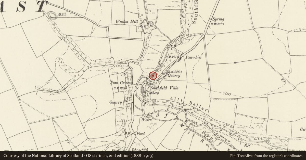
Slide toward Today to fade the historical sheet and see the modern map underneath.
David Rumsey Map Collection, Stanford LibrariesDavid Rumsey Map Collection, Stanford LibrariesDavid Rumsey Map Collection, Stanford LibrariesDavid Rumsey Map Collection, Stanford LibrariesDavid Rumsey Map Collection, Stanford Libraries
5 historical maps cover this location, the earliest the 1608 map "(13) Cambriae Typus." (David Rumsey Map Collection, Stanford Libraries).
Historical maps covering this location
- 1608 · (13) Cambriae Typus. (David Rumsey Map Collection, Stanford Libraries)
- 1636 · Cornubia : Devonia, Somersetus, Dorcestria, Wiltonia, Glocestria ... (David Rumsey Map Collection, Stanford Libraries)
- 1891 · Sheet 10. Ordnance Survey of England and Wales. . (David Rumsey Map Collection, Stanford Libraries)
- 1898 · 210 Cardigan (Hills) (David Rumsey Map Collection, Stanford Libraries)
- 1901 · Sheet 13. (David Rumsey Map Collection, Stanford Libraries)
Cadw's description
Location
Between the road and the Afon Syfni some 100m SE of Pont Crwca.
History
Small single storey cottage of late C18 date, part of the Southfield estate, owned by the Philipps family. Restored c. 2000 for the Southfield estate, when an Irish halfpenny of the 1730s was found. On 1881 census occupied by John Thomas, labourer, his wife and six children.
Exterior
Cottage, white-painted render on rubble stone with slate roof. Large square stone right end stack, tiny renewed brick left stack. Small scale, single-storey, facade offset slightly to right. Double-fronted with 12-pane hornless sash each side of board door, the left sash narrower. C20 extension to rear.
Interior
Two room plan open to roof which has four pegged collar trusses. Right end chimneybreast with oak lintel.
Reason for designation
Included for its special interest as a vernacular cottage of definitely early date for this region with good surviving features.
Nearby in the register
- Southfield VillaDomesticunder 1 mi
- 1 and 2 Penrhiw CottagesDomesticunder 1 mi
- Walton Mill RathEnclosureunder 1 mi
- Parc-y-delynDomesticunder 1 mi
Other entries of the same register within about three miles of this one, by straight line.