Cof Cymru: National Historic Assets of Wales · Wales
1 and 2 Penrhiw Cottages
New Moat, Pembrokeshire, Wales
A Grade II listed building in Llys-y-fran, Clarbeston Road, New Moat, Pembrokeshire, designated on 15 October 2004.
The record
- Designation
- Listed building, Grade II
- Broad class
- Domestic
- Date of designation
- 15 October 2004
- Locality
- Llys-y-fran
- Town
- Clarbeston Road
- Community
- New Moat
- Unitary authority
- Pembrokeshire
- Country
- Wales
- Coordinates
- 51.86936, -4.84885
- Cadw reference
- 83171
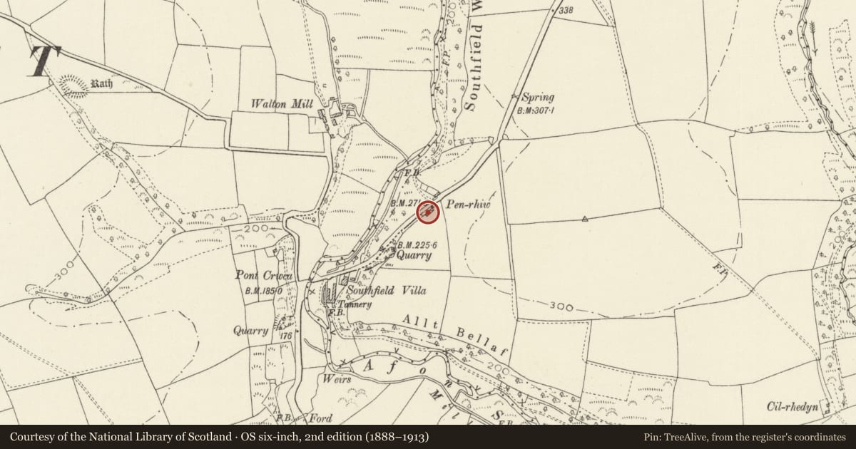
Slide toward Today to fade the historical sheet and see the modern map underneath.
David Rumsey Map Collection, Stanford LibrariesDavid Rumsey Map Collection, Stanford LibrariesDavid Rumsey Map Collection, Stanford LibrariesDavid Rumsey Map Collection, Stanford LibrariesDavid Rumsey Map Collection, Stanford Libraries
5 historical maps cover this location, the earliest the 1608 map "(13) Cambriae Typus." (David Rumsey Map Collection, Stanford Libraries).
Historical maps covering this location
- 1608 · (13) Cambriae Typus. (David Rumsey Map Collection, Stanford Libraries)
- 1636 · Cornubia : Devonia, Somersetus, Dorcestria, Wiltonia, Glocestria ... (David Rumsey Map Collection, Stanford Libraries)
- 1891 · Sheet 10. Ordnance Survey of England and Wales. . (David Rumsey Map Collection, Stanford Libraries)
- 1898 · 210 Cardigan (Hills) (David Rumsey Map Collection, Stanford Libraries)
- 1901 · Sheet 13. (David Rumsey Map Collection, Stanford Libraries)
Cadw's description
Location
On the E side of a minor road to Gwasted some 300m NE of Pont Crwca.
History
Pair of single-storey lofted cottages, now one house, C19, part of the Southfield estate owned by the Philipps family. Carefully restored in late C20 by Southfield estate.
Exterior
Pair of cottages now one house, white-painted rubble stone with close-eaved slate roof and three red brick chimneys. Single-storey, two double-fronted houses, each with renewed 8-pane horned sash each side of board door. Slate sills, cambered brick heads. Loft windows in end walls. Rear is rubble stone with one door to left of centre and tiny window to right of door.
Interior
Not inspected.
Reason for designation
Included for their special interest as a pair of traditional single-storey cottages of regional type, now rare.
Nearby in the register
- Nyth y Dryw/ Wren's NestDomesticunder 1 mi
- Southfield VillaDomesticunder 1 mi
- Parc-y-delynDomesticunder 1 mi
- Walton Mill RathEnclosureunder 1 mi
Other entries of the same register within about three miles of this one, by straight line.