Cof Cymru: National Historic Assets of Wales · Wales
Gate piers, gates and attached walls at entrance to The Hall
Abbey Cwmhir, Powys, Wales
A Grade II listed building in Abey Cwmhir, Abbey Cwmhir, Powys, designated on 3 September 2004.
The record
- Designation
- Listed building, Grade II
- Broad class
- No class recorded
- Date of designation
- 3 September 2004
- Locality
- Abey Cwmhir
- Community
- Abbey Cwmhir
- Unitary authority
- Powys
- Country
- Wales
- Coordinates
- 52.33069, -3.38767
- Cadw reference
- 83094
Slide toward Today to fade the historical sheet and see the modern map underneath.
David Rumsey Map Collection, Stanford LibrariesDavid Rumsey Map Collection, Stanford LibrariesDavid Rumsey Map Collection, Stanford LibrariesDavid Rumsey Map Collection, Stanford LibrariesDavid Rumsey Map Collection, Stanford Libraries
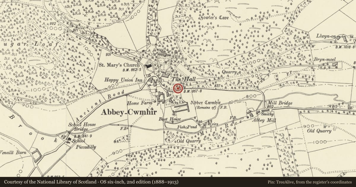
5 historical maps cover this location, the earliest the 1608 map "(13) Cambriae Typus." (David Rumsey Map Collection, Stanford Libraries).
Historical maps covering this location
- 1608 · (13) Cambriae Typus. (David Rumsey Map Collection, Stanford Libraries)
- 1637 · Particular description of Wales. Cambria seu Wallia (David Rumsey Map Collection, Stanford Libraries)
- 1883 · Watershed map England, Wales 3. (David Rumsey Map Collection, Stanford Libraries)
- 1898 · 179 Rhyader (Hills) (David Rumsey Map Collection, Stanford Libraries)
- 1901 · Sheet 14. (David Rumsey Map Collection, Stanford Libraries)
Cadw's description
Location
At the SE entrance to the house and continuing on the S side of the gardens facing the road through the village.
History
Built in 1867 by J.W. Poundley & D. Walker, architects of the house and parish church.
Exterior
Freestone piers have gabled caps with sunk trefoils, and iron gates. Flanking these are rubble and freestone piers, and railings on dwarf walls, beyond which is a coped rubble-stone wall. The wall is longer on the SW side, fronting the road into the village and forming the S boundary of the formal garden, where there is a pointed gateway with iron gate, immediately S of the house. The gate gave access from the house to the abbey ruins, which were part of the pleasure gardens until c1900. The coped boundary wall continues further W to a sharp bend in the road at the SW corner of the gardens opposite Home Farm, beyond which it is plainer.
Reason for designation
Listed as a well-detailed gateway and boundary wall contributing to the setting of the house and to the overall historic character of the village.
Nearby in the register
- NE farm range at Home FarmNo class recordedunder 1 mi
- Home FarmhouseNo class recordedunder 1 mi
- Tympanum in garden wall at Home FarmNo class recordedunder 1 mi
- Telephone Call-box at entrance to Home FarmNo class recordedunder 1 mi
Other entries of the same register within about three miles of this one, by straight line.