Cof Cymru: National Historic Assets of Wales · Wales
Pont Felin y ffridd (partly in Corris Community)
Glantwymyn, Powys, Wales
A Grade II listed building in Llanwrin, Glantwymyn, Powys, designated on 5 August 2004.
The record
- Designation
- Listed building, Grade II
- Broad class
- No class recorded
- Date of designation
- 5 August 2004
- Locality
- Llanwrin
- Community
- Glantwymyn
- Unitary authority
- Powys
- Country
- Wales
- Coordinates
- 52.60535, -3.84441
- Cadw reference
- 83040
Slide toward Today to fade the historical sheet and see the modern map underneath.
David Rumsey Map Collection, Stanford LibrariesDavid Rumsey Map Collection, Stanford LibrariesDavid Rumsey Map Collection, Stanford LibrariesLlyfrgell Genedlaethol Cymru – The National Library of WalesDavid Rumsey Map Collection, Stanford Libraries
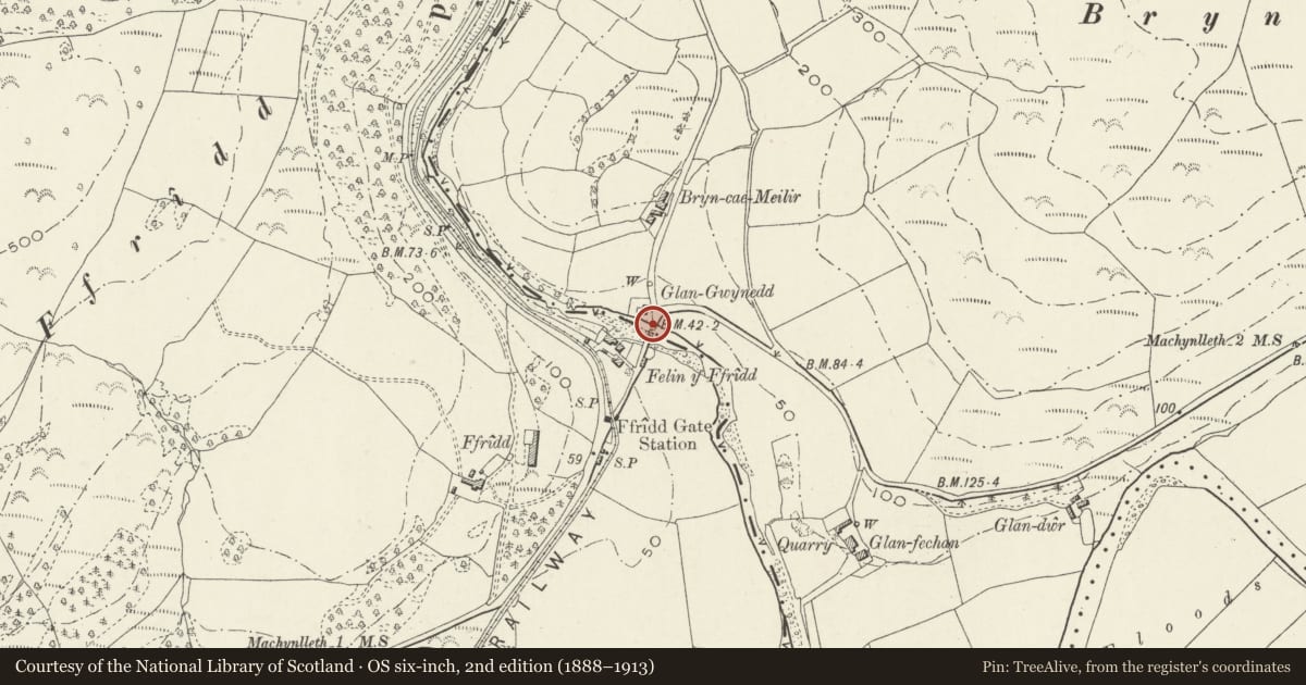
5 historical maps cover this location, the earliest the 1795 map "To Sir Watkin Williams-Wynn Bart ... the map of the six counties of North Wales is most humbly inscribed by his obedient humble servant" (Llyfrgell Genedlaethol Cymru – The National Library of Wales).
Historical maps covering this location
- 1795 · To Sir Watkin Williams-Wynn Bart ... the map of the six counties of North Wales is most… (Llyfrgell Genedlaethol Cymru – The National Library of Wales)
- 1830 · V.3:11-15:XV. Britisches Reich. A. Kon: England. b. Frstenthum Wales: Shire: 37-40 (David Rumsey Map Collection, Stanford Libraries)
- 1883 · Watershed map England, Wales 3. (David Rumsey Map Collection, Stanford Libraries)
- 1899 · 149 Barmouth (Hills) (David Rumsey Map Collection, Stanford Libraries)
- 1901 · Sheet 9 and 10. (David Rumsey Map Collection, Stanford Libraries)
Cadw's description
Location
The bridge carries the road from Machynlleth over the Afon Dulas into Powys, in the direction of Llanwrin.
History
The bridge is probably of the C18.
Exterior
Built of rubble stone throughout. Two low arches and a secondary flood arch rising from two water piers.
The two main arches are constructed of regular grey slate stone voussoirs set back under a regulating
course, and spanning on to a central water pier with cutwaters up and down stream, stepped back to flush
spandrels and parapet. Each arch spans approximately 7.95m and carries a carriageway of 4.35m with
parapets 55cm wide, finished with packed stone-on-edge copings. The secondary arch is lower, and of
similar construction. The upstream cutwater on the main water pier has been replaced with concrete, and the body of the bridge has been strengthened by 8 tie bars and iron compression plates.
Reason for designation
Included as a handsome and well-preserved road bridge of C18 character.
Nearby in the register
- Pont Felin-y-ffriddTransportunder 1 mi
- Turnpike CottageTransportunder 1 mi
- Ffridd round barrowsRound Barrowunder 1 mi
- Dol-y-dderwinDomesticunder 1 mi
Other entries of the same register within about three miles of this one, by straight line.