Cof Cymru: National Historic Assets of Wales · Wales
13 High Street
Llanidloes, Powys, Wales
A Grade II listed building in Llanidloes, Powys, designated on 10 April 1989.
The record
- Designation
- Listed building, Grade II
- Broad class
- Domestic
- Date of designation
- 10 April 1989
- Town
- Llanidloes
- Community
- Llanidloes
- Unitary authority
- Powys
- Country
- Wales
- Coordinates
- 52.44729, -3.53833
- Cadw reference
- 8304
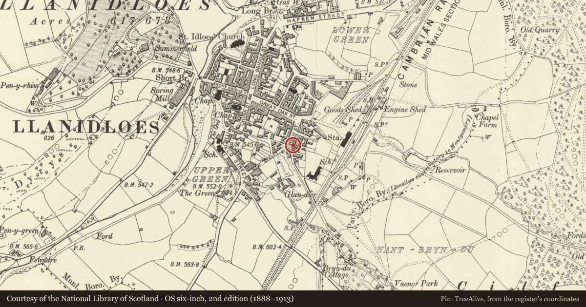
Slide toward Today to fade the historical sheet and see the modern map underneath.
David Rumsey Map Collection, Stanford LibrariesDavid Rumsey Map Collection, Stanford LibrariesDavid Rumsey Map Collection, Stanford LibrariesDavid Rumsey Map Collection, Stanford LibrariesDavid Rumsey Map Collection, Stanford Libraries
5 historical maps cover this location, the earliest the 1608 map "(13) Cambriae Typus." (David Rumsey Map Collection, Stanford Libraries).
Historical maps covering this location
- 1608 · (13) Cambriae Typus. (David Rumsey Map Collection, Stanford Libraries)
- 1637 · Particular description of Wales. Cambria seu Wallia (David Rumsey Map Collection, Stanford Libraries)
- 1883 · Watershed map England, Wales 3. (David Rumsey Map Collection, Stanford Libraries)
- 1899 · 164 Llanidloes (Hills) (David Rumsey Map Collection, Stanford Libraries)
- 1901 · Sheet 14. (David Rumsey Map Collection, Stanford Libraries)
Cadw's description
Location
Attached to and slightly splayed back from Nos 5 to 10, near the junction with New Street.
History
Mid to late C19 (shown on 1887 map)
Exterior
Group of 3-storey, 1 window fronts, Nos 12 and 13 are reflected pairs. Red brick with some stock brick headers, plinth and 1st floor cill band; slate roof, boarded eaves and stock and red brick stacks, partly slate hung. Small pane sash windows, 9-pane to 2nd floor and 12-pane to 1st floor, (2-windows flanking entrance) to No 11 and sash windows to Nos 12 and 13 (small pane to the former) beside 4-panel doors.
The rear elevation overlooks the same courtyard as the shoepermarket to No 10.
It is closed to S by a similar 2-storey range, part weatherboarded, which adjoins the rear of the shallower No 13.
Reason for designation
Included for group value.
Nearby in the register
- 12 High StreetDomesticunder 1 mi
- 11 High StreetCommercialunder 1 mi
- 10 High StreetCommercialunder 1 mi
- 9 High StreetCommercialunder 1 mi
Other entries of the same register within about three miles of this one, by straight line.