Cof Cymru: National Historic Assets of Wales · Wales
Ty'r Goron (Crown House)
Usk, Monmouthshire, Wales
A Grade II listed building in Usk, Monmouthshire, designated on 30 April 2004.
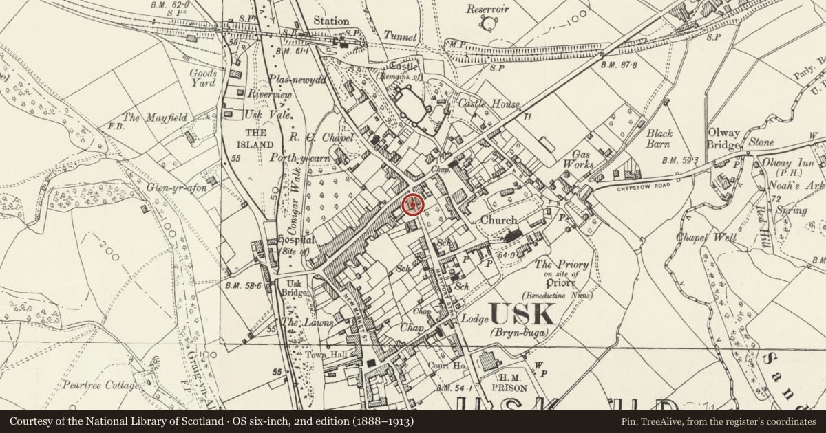
The record
- Designation
- Listed building, Grade II
- Broad class
- No class recorded
- Date of designation
- 30 April 2004
- Locality
- Usk
- Town
- Usk
- Community
- Usk
- Unitary authority
- Monmouthshire
- Country
- Wales
- Coordinates
- 51.70317, -2.90333
- Cadw reference
- 82791
Slide toward Today to fade the historical sheet and see the modern map underneath.
David Rumsey Map Collection, Stanford LibrariesDavid Rumsey Map Collection, Stanford LibrariesDavid Rumsey Map Collection, Stanford LibrariesDavid Rumsey Map Collection, Stanford LibrariesDavid Rumsey Map Collection, Stanford Libraries
5 historical maps cover this location, the earliest the 1636 map "Cornubia : Devonia, Somersetus, Dorcestria, Wiltonia, Glocestria ..." (David Rumsey Map Collection, Stanford Libraries).
Historical maps covering this location
- 1636 · Cornubia : Devonia, Somersetus, Dorcestria, Wiltonia, Glocestria ... (David Rumsey Map Collection, Stanford Libraries)
- 1637 · The fourth table of England. Cornub. Devonia, Somerset etc. (David Rumsey Map Collection, Stanford Libraries)
- 1830 · V.3:11-15:XV.Britisches Reich. A. Kon: England. a. England ab sich: Shire:15-17, 33 (David Rumsey Map Collection, Stanford Libraries)
- 1895 · Sheet 11. Ordnance Survey of England and Wales. (David Rumsey Map Collection, Stanford Libraries)
- 1913 · Sheet 102. Newport. (David Rumsey Map Collection, Stanford Libraries)
Cadw's description
Location
On street line about 30 metres S of Bridge Street.
History
Early-to-mid C19 house said to have been built for governor of Usk Prison.
Exterior
Two storey, 3 bay house, scribed stucco, slate roofs. Central gabled pediment. First floor has, to R, 2 tripartite small-pane sashes, hornless. recessed doorway with rectangular overlight with slim pilasters to sides; C19 door with central octagonal panel, rectangular panels above and below. To L of door, horned tripartite sash window. The L bay of the house has a first floor splayed oriel with sash glazing over C20 vehicle entrance. Two windows to L gable at attic height.
Reason for designation
Mid C19 house with surviving character, and historic interest with Group Value with listed buildings opposite in Maryport Street.
Nearby in the register
- 9 Maryport StreetDomesticunder 1 mi
- 7 Maryport StreetDomesticunder 1 mi
- 5 Maryport StreetDomesticunder 1 mi
- 3 Maryport StreetDomesticunder 1 mi
Other entries of the same register within about three miles of this one, by straight line.