Cof Cymru: National Historic Assets of Wales · Wales
40 Maryport Street
Usk, Monmouthshire, Wales
A Grade II listed building in Usk, Monmouthshire, designated on 30 April 2004.
The record
- Designation
- Listed building, Grade II
- Broad class
- Domestic
- Date of designation
- 30 April 2004
- Locality
- Usk
- Town
- Usk
- Community
- Usk
- Unitary authority
- Monmouthshire
- Country
- Wales
- Coordinates
- 51.70120, -2.90232
- Cadw reference
- 82740
Slide toward Today to fade the historical sheet and see the modern map underneath.
David Rumsey Map Collection, Stanford LibrariesDavid Rumsey Map Collection, Stanford LibrariesDavid Rumsey Map Collection, Stanford LibrariesDavid Rumsey Map Collection, Stanford LibrariesDavid Rumsey Map Collection, Stanford Libraries
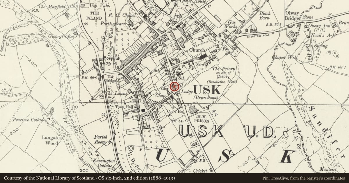
5 historical maps cover this location, the earliest the 1636 map "Cornubia : Devonia, Somersetus, Dorcestria, Wiltonia, Glocestria ..." (David Rumsey Map Collection, Stanford Libraries).
Historical maps covering this location
- 1636 · Cornubia : Devonia, Somersetus, Dorcestria, Wiltonia, Glocestria ... (David Rumsey Map Collection, Stanford Libraries)
- 1830 · V.3:11-15:XV.Britisches Reich. A. Kon: England. a. England ab sich: Shire:15-17, 33 (David Rumsey Map Collection, Stanford Libraries)
- 1895 · Sheet 11. Ordnance Survey of England and Wales. (David Rumsey Map Collection, Stanford Libraries)
- 1905 · 250 Chepstow (Hills) (David Rumsey Map Collection, Stanford Libraries)
- 1913 · Sheet 102. Newport. (David Rumsey Map Collection, Stanford Libraries)
Cadw's description
Location
Near the lower end of the upper W range of Maryport Street, by the corner with Old Market Street, no.38 attached to the former chapel.
Exterior
Belongs to a group of 3
Nos.38-42 Maryport Street (Even Nos)
Terrace of three cottages, attached at each side. Rendered and painted with slate roof and yellow brick corniced ridge stacks. Two storeys. Windows are 4-pane casements to first floor; mostly sashes and plain doorways without surrounds to ground floor. An asymmetrical range. Number 38 to right has a single window range, small pitched-roof ground floor bay window with single-pane opening casements, 6-panelled door. Number 40 is double-fronted with a 2-window range; central ground floor doorway with part-glazed door, 6-pane sash to R and canted bay with fixed glazing to L. Number 42 to L has a 2-window range; two ground floor doorways, at centre with 4-panelled door and at right with boarded door; wider canted bay to L with C20 glazing. Plinth.
Reason for designation
Listed as part of a terrace of houses retaining its historic character. Group value with other listed buildings in Maryport Street.
Nearby in the register
- 38 Maryport StreetDomesticunder 1 mi
- 42 Maryport StreetDomesticunder 1 mi
- 32 Maryport StreetDomesticunder 1 mi
- No.1 Old Market Street, and attached iron railingsDomesticunder 1 mi
Other entries of the same register within about three miles of this one, by straight line.