Cof Cymru: National Historic Assets of Wales · Wales
32 Maryport Street
Usk, Monmouthshire, Wales
A Grade II listed building in Usk, Monmouthshire, designated on 1 April 1974.
The record
- Designation
- Listed building, Grade II
- Broad class
- Domestic
- Date of designation
- 1 April 1974
- Locality
- Usk
- Town
- Usk
- Community
- Usk
- Unitary authority
- Monmouthshire
- Country
- Wales
- Coordinates
- 51.70149, -2.90247
- Cadw reference
- 2148
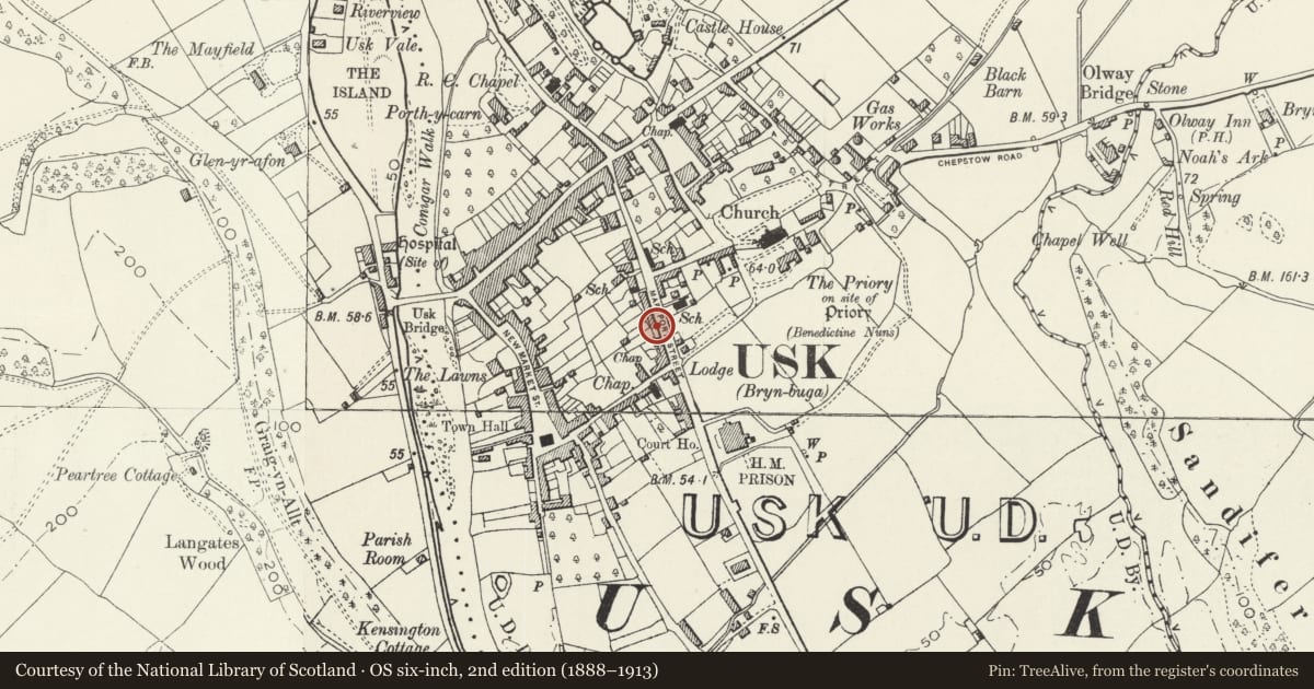
Slide toward Today to fade the historical sheet and see the modern map underneath.
David Rumsey Map Collection, Stanford LibrariesDavid Rumsey Map Collection, Stanford LibrariesDavid Rumsey Map Collection, Stanford LibrariesDavid Rumsey Map Collection, Stanford LibrariesDavid Rumsey Map Collection, Stanford Libraries
5 historical maps cover this location, the earliest the 1636 map "Cornubia : Devonia, Somersetus, Dorcestria, Wiltonia, Glocestria ..." (David Rumsey Map Collection, Stanford Libraries).
Historical maps covering this location
- 1636 · Cornubia : Devonia, Somersetus, Dorcestria, Wiltonia, Glocestria ... (David Rumsey Map Collection, Stanford Libraries)
- 1830 · V.3:11-15:XV.Britisches Reich. A. Kon: England. a. England ab sich: Shire:15-17, 33 (David Rumsey Map Collection, Stanford Libraries)
- 1895 · Sheet 11. Ordnance Survey of England and Wales. (David Rumsey Map Collection, Stanford Libraries)
- 1905 · 250 Chepstow (Hills) (David Rumsey Map Collection, Stanford Libraries)
- 1913 · Sheet 102. Newport. (David Rumsey Map Collection, Stanford Libraries)
Cadw's description
Location
Part of a group set back from the road, towards the lower end of the upper W range of the street.
History
Probably C18 though probably with earlier origins. C19 photos show the building before re-windowing and before doorway altered.
Exterior
Townhouse with classical detail, attached at and projecting from each side. Roughcast rendered with painted rendered Gibbs-style surrounds to windows; slate roof with rendered lateral and rear stacks with red and yellow brick chimneys. Two storeys and attic. Gable end facade. Single window range: attic light has round head and pointed-arched lights; first and ground floor windows are 16-pane casements with shallow rendered pediments. Doorway at left with bracketed gabled hood; recessed 4-panelled door with plain overlight, 4 steps up.
Interior
Reported as retaining good Georgian fittings, doors, surrounds etc.
Reason for designation
Listed as a town house retaining historic fabric and character. Group value with other listed buildings in Maryport Street.
Nearby in the register
- 30 Maryport StreetDomesticunder 1 mi
- Ashley HouseDomesticunder 1 mi
- 38 Maryport StreetDomesticunder 1 mi
- Wood Cutter's CottageDomesticunder 1 mi
Other entries of the same register within about three miles of this one, by straight line.