Cof Cymru: National Historic Assets of Wales · Wales
Bronwylfa
Llansantffraid, Powys, Wales
A Grade II listed building in Llansantffraid-ym-Mechain village, Llansantffraid, Powys, designated on 2 March 2004.
The record
- Designation
- Listed building, Grade II
- Broad class
- Domestic
- Date of designation
- 2 March 2004
- Locality
- Llansantffraid-ym-Mechain village
- Community
- Llansantffraid
- Unitary authority
- Powys
- Country
- Wales
- Coordinates
- 52.77556, -3.15877
- Cadw reference
- 82550
Slide toward Today to fade the historical sheet and see the modern map underneath.
David Rumsey Map Collection, Stanford LibrariesDavid Rumsey Map Collection, Stanford LibrariesDavid Rumsey Map Collection, Stanford LibrariesDavid Rumsey Map Collection, Stanford LibrariesLlyfrgell Genedlaethol Cymru – The National Library of Wales
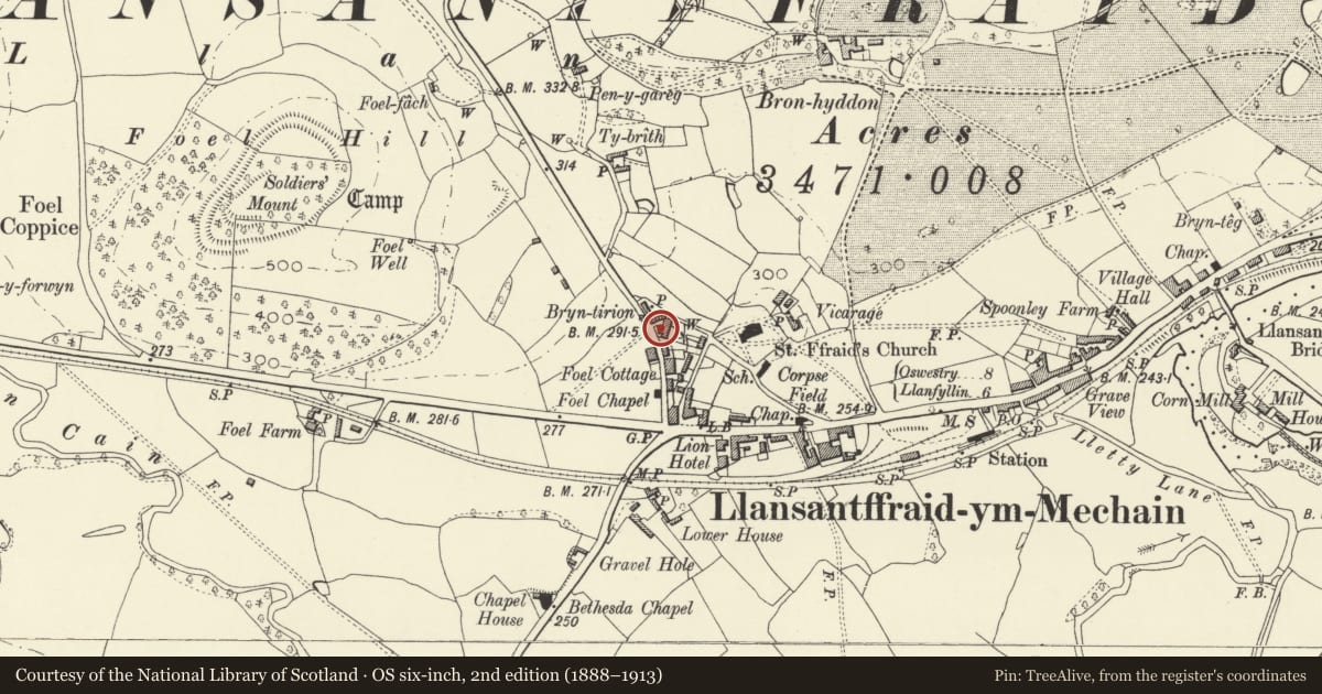
5 historical maps cover this location, the earliest the 1795 map "To Sir Watkin Williams-Wynn Bart ... the map of the six counties of North Wales is most humbly inscribed by his obedient humble servant" (Llyfrgell Genedlaethol Cymru – The National Library of Wales).
Historical maps covering this location
- 1795 · To Sir Watkin Williams-Wynn Bart ... the map of the six counties of North Wales is most… (Llyfrgell Genedlaethol Cymru – The National Library of Wales)
- 1883 · Watershed map England, Wales 3. (David Rumsey Map Collection, Stanford Libraries)
- 1897 · 137 Oswestry (Hills) (David Rumsey Map Collection, Stanford Libraries)
- 1901 · Sheet 9 and 10. (David Rumsey Map Collection, Stanford Libraries)
- 1916 · Sheet 60. Shrewsbury. (David Rumsey Map Collection, Stanford Libraries)
Cadw's description
Location
About 100 m north of the Lion Hotel, at the east side of Winllan Road.
History
Bronwylfa displays a datestone in the front gable reading "WST / 1862". It is thus contemporary with Glanaber and possibly also with Llwyn Onn to its rear, with the latter of which it stands back-to-back.
Exterior
A two-storey, three window symmetrically planned house, the centre bay of the front standing slightly forward and gabled, as if pedimented. The front is clad in slates, which return a small distance at the left side; the exposed part of the left side and the right side is in yellow brick. White painted eaves and verges. Slate roof with tile ridge; yellow brick end chimneys.
Flat-roofed slate-hung porch to main entrance, containing a framed panel with side and upper lighting and glazed double doors; white painted cornice. The three upper and two lower windows are of 16-pane hornless-sash type.
Interior
Interior not seen.
Reason for designation
A good mid Victorian house, which has retained its character and constitutes an element in an interesting housing group of the pre-planning era.
Nearby in the register
- Llwyn OnnDomesticunder 1 mi
- GlanaberDomesticunder 1 mi
- BryntirionDomesticunder 1 mi
- Lion HotelCommercialunder 1 mi
Other entries of the same register within about three miles of this one, by straight line.