Cof Cymru: National Historic Assets of Wales · Wales
White Lion Inn
Trawsfynydd, Gwynedd, Wales
A Grade II listed building in Trawsfynydd, Gwynedd, designated on 27 February 2004.
The record
- Designation
- Listed building, Grade II
- Broad class
- Commercial
- Date of designation
- 27 February 2004
- Locality
- Trawsfynydd
- Community
- Trawsfynydd
- Unitary authority
- Gwynedd
- Country
- Wales
- Coordinates
- 52.90320, -3.92297
- Cadw reference
- 82546
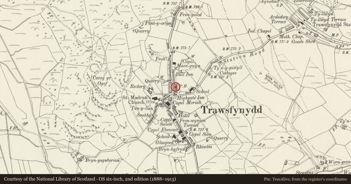
Slide toward Today to fade the historical sheet and see the modern map underneath.
David Rumsey Map Collection, Stanford LibrariesDavid Rumsey Map Collection, Stanford LibrariesDavid Rumsey Map Collection, Stanford LibrariesLlyfrgell Genedlaethol Cymru – The National Library of WalesDavid Rumsey Map Collection, Stanford Libraries
5 historical maps cover this location, the earliest the 1795 map "To Sir Watkin Williams-Wynn Bart ... the map of the six counties of North Wales is most humbly inscribed by his obedient humble servant" (Llyfrgell Genedlaethol Cymru – The National Library of Wales).
Historical maps covering this location
- 1795 · To Sir Watkin Williams-Wynn Bart ... the map of the six counties of North Wales is most… (Llyfrgell Genedlaethol Cymru – The National Library of Wales)
- 1883 · Watershed map England, Wales 3. (David Rumsey Map Collection, Stanford Libraries)
- 1896 · Sheet 7. Ordnance Survey of England and Wales. (David Rumsey Map Collection, Stanford Libraries)
- 1899 · 135 Harlech (Hills) (David Rumsey Map Collection, Stanford Libraries)
- 1901 · Sheet 9 and 10. (David Rumsey Map Collection, Stanford Libraries)
Cadw's description
Location
Set alongside the E side of the Pen y Garreg Street leading N out of the village of Trawsfynydd.
History
Mid to late C19 public house. The village of Trawsfynydd developed as a quarrying community in the latter half of the C19.
Exterior
Two storey public house, built of coursed, roughly dressed local stones including extremely long stones forming a continous lintel course across the ground floor openings. Slate roof with advanced eaves and rectangular stacks with dripstones and capping; there are gable stacks to either end and a single ridge stack offset to the R (S). The principal elevation faces the street to the W, the main door offset to the L (N) under a shallow overlight and is flanked by 4-pane horned sash windows; there is another (delivery) door at the far R (S) end and 3 similar first floor windows regularly spaced across the elevation.
Reason for designation
Listed as a C19 public house that retains good traditional character, contemporary with the main phase of the development of the village.
Nearby in the register
- Statue of Hedd WynCommemorativeunder 1 mi
- Capel Moriah FroReligious, Ritual and Funeraryunder 1 mi
- Church of St MadrynReligious, Ritual and Funeraryunder 1 mi
- Pont TrawsfynyddTransportunder 1 mi
Other entries of the same register within about three miles of this one, by straight line.