Cof Cymru: National Historic Assets of Wales · Wales
Station House
Neyland, Pembrokeshire, Wales
A Grade II listed building in Neyland, Milford Haven, Pembrokeshire, designated on 26 February 2004.
The record
- Designation
- Listed building, Grade II
- Broad class
- Domestic
- Date of designation
- 26 February 2004
- Locality
- Neyland
- Town
- Milford Haven
- Community
- Neyland
- Unitary authority
- Pembrokeshire
- Country
- Wales
- Coordinates
- 51.70597, -4.94591
- Cadw reference
- 82529
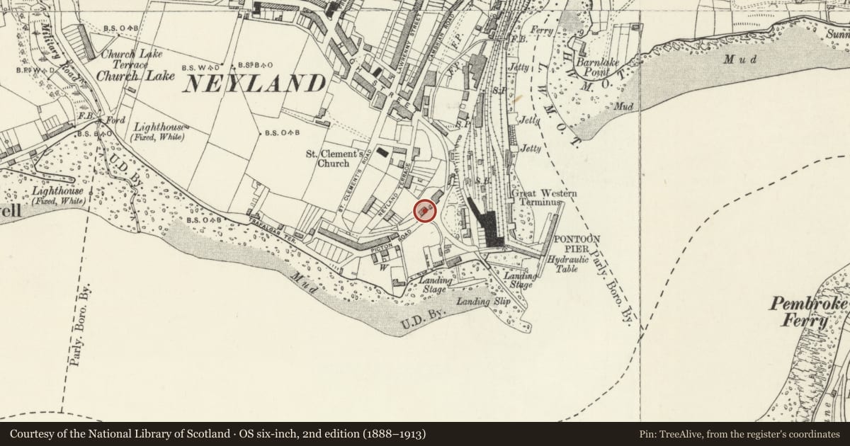
Slide toward Today to fade the historical sheet and see the modern map underneath.
David Rumsey Map Collection, Stanford LibrariesDavid Rumsey Map Collection, Stanford LibrariesDavid Rumsey Map Collection, Stanford LibrariesDavid Rumsey Map Collection, Stanford LibrariesDavid Rumsey Map Collection, Stanford Libraries
5 historical maps cover this location, the earliest the 1636 map "Cornubia : Devonia, Somersetus, Dorcestria, Wiltonia, Glocestria ..." (David Rumsey Map Collection, Stanford Libraries).
Historical maps covering this location
- 1636 · Cornubia : Devonia, Somersetus, Dorcestria, Wiltonia, Glocestria ... (David Rumsey Map Collection, Stanford Libraries)
- 1865 · England and Wales. England No. 6. (David Rumsey Map Collection, Stanford Libraries)
- 1891 · Sheet 10. Ordnance Survey of England and Wales. . (David Rumsey Map Collection, Stanford Libraries)
- 1898 · 228 Haverfordwest (Hills) (David Rumsey Map Collection, Stanford Libraries)
- 1901 · Sheet 13. (David Rumsey Map Collection, Stanford Libraries)
Cadw's description
Location
Facing Brunel Quay at the junction of Picton Road, High Street and Station Road.
History
Built c1857 on site of Stag Inn, residence of station masters until closure of railway in 1964 when it became a private house.
Exterior
House, painted stucco with slate deep eaved roof and red brick end stacks, left stack missing. Two-storey, 3-window broad facade with large 16-pane sashes and centre door with overlight set in gabled trellis porch. Attached on each end is a Gothic pointed doorway with cut stone voussoirs and raised string course above, left doorway built into added lean-to, right doorway with coping stones over arch.
Interior
Not inspected.
Reason for designation
Included as a well-designed mid C19 house, the most significant single building surviving of the Brunel railway town.
Nearby in the register
- Pillar Box near Station HouseCommunicationsunder 1 mi
- The War MemorialCommemorativeunder 1 mi
- Lime kiln at Church LakeAgriculture and Subsistenceunder 1 mi
- Two Bollards on N Side of QuayGardens, Parks and Urban Spacesunder 1 mi
Other entries of the same register within about three miles of this one, by straight line.