Cof Cymru: National Historic Assets of Wales · Wales
Lime kiln at Church Lake
Neyland, Pembrokeshire, Wales
A Grade II listed building in Neyland, Milford Haven, Pembrokeshire, designated on 26 February 2004.
The record
- Designation
- Listed building, Grade II
- Broad class
- Agriculture and Subsistence
- Date of designation
- 26 February 2004
- Locality
- Neyland
- Town
- Milford Haven
- Community
- Neyland
- Unitary authority
- Pembrokeshire
- Country
- Wales
- Coordinates
- 51.70793, -4.95539
- Cadw reference
- 82528
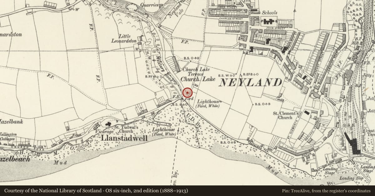
Slide toward Today to fade the historical sheet and see the modern map underneath.
David Rumsey Map Collection, Stanford LibrariesDavid Rumsey Map Collection, Stanford LibrariesDavid Rumsey Map Collection, Stanford LibrariesDavid Rumsey Map Collection, Stanford LibrariesDavid Rumsey Map Collection, Stanford Libraries
5 historical maps cover this location, the earliest the 1636 map "Cornubia : Devonia, Somersetus, Dorcestria, Wiltonia, Glocestria ..." (David Rumsey Map Collection, Stanford Libraries).
Historical maps covering this location
- 1636 · Cornubia : Devonia, Somersetus, Dorcestria, Wiltonia, Glocestria ... (David Rumsey Map Collection, Stanford Libraries)
- 1865 · England and Wales. England No. 6. (David Rumsey Map Collection, Stanford Libraries)
- 1891 · Sheet 10. Ordnance Survey of England and Wales. . (David Rumsey Map Collection, Stanford Libraries)
- 1898 · 228 Haverfordwest (Hills) (David Rumsey Map Collection, Stanford Libraries)
- 1901 · Sheet 13. (David Rumsey Map Collection, Stanford Libraries)
Cadw's description
Location
Built into the valley side on the W side of Neyland some 400m E of the Church of Saint Tudwal at Llanstadwell.
History
Lime kiln, probably early C19, built into valley side to NE.
Exterior
Lime kiln, square plan, coursed rubble stone with retaining wall to SE Large tapering kiln-eye on SW side with shallow segmental arch of dressed stone voussoirs. Crucible said to remain and covered.
Reason for designation
Included as a well-preserved C19 lime-kiln of historical interest.
Nearby in the register
- The War MemorialCommemorativeunder 1 mi
- Church of Saint TudwalReligious, Ritual and Funeraryunder 1 mi
- Station HouseDomesticunder 1 mi
- Pillar Box near Station HouseCommunicationsunder 1 mi
Other entries of the same register within about three miles of this one, by straight line.