Cof Cymru: National Historic Assets of Wales · Wales
Y Bwthyn, Hebron Chapel
Cilymaenllwyd, Carmarthenshire, Wales
A Grade II listed building in Hebron, Cilymaenllwyd, Carmarthenshire, designated on 10 February 2004.
The record
- Designation
- Listed building, Grade II
- Broad class
- No class recorded
- Date of designation
- 10 February 2004
- Locality
- Hebron
- Community
- Cilymaenllwyd
- Unitary authority
- Carmarthenshire
- Country
- Wales
- Coordinates
- 51.91825, -4.64665
- Cadw reference
- 82463
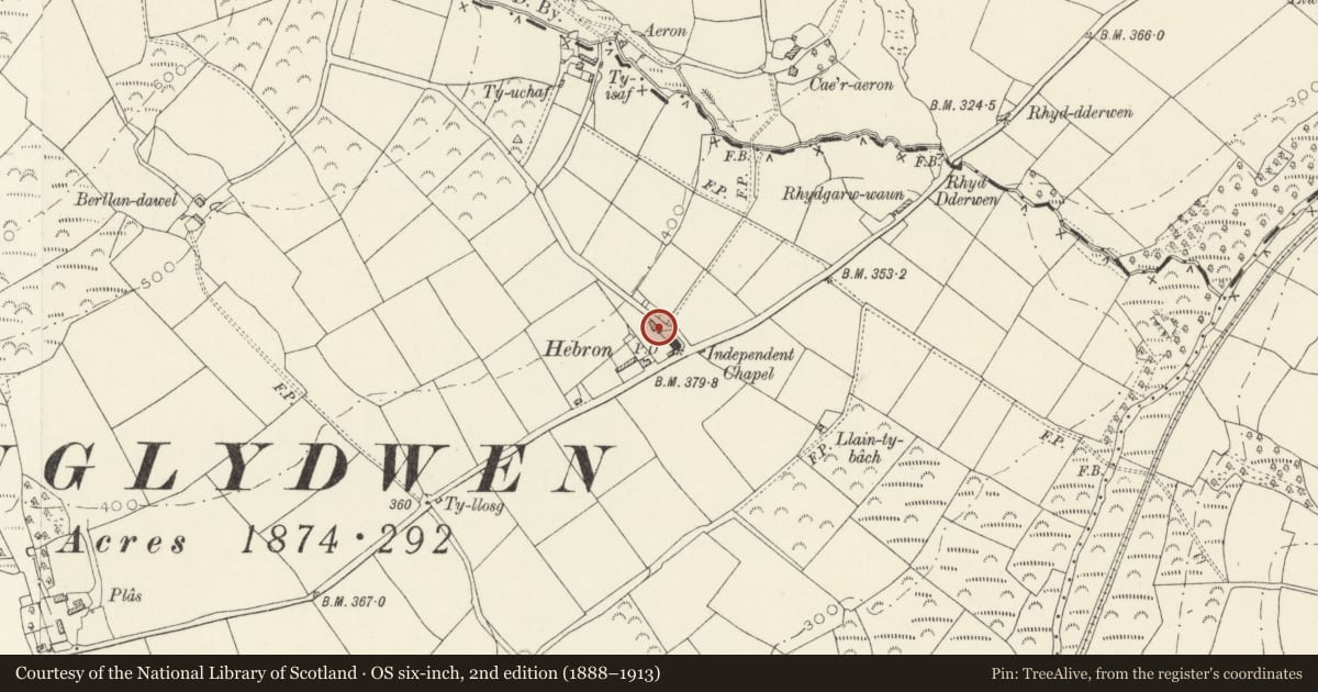
Slide toward Today to fade the historical sheet and see the modern map underneath.
David Rumsey Map Collection, Stanford LibrariesDavid Rumsey Map Collection, Stanford LibrariesDavid Rumsey Map Collection, Stanford LibrariesDavid Rumsey Map Collection, Stanford LibrariesDavid Rumsey Map Collection, Stanford Libraries
5 historical maps cover this location, the earliest the 1636 map "Cornubia : Devonia, Somersetus, Dorcestria, Wiltonia, Glocestria ..." (David Rumsey Map Collection, Stanford Libraries).
Historical maps covering this location
- 1636 · Cornubia : Devonia, Somersetus, Dorcestria, Wiltonia, Glocestria ... (David Rumsey Map Collection, Stanford Libraries)
- 1891 · Sheet 10. Ordnance Survey of England and Wales. . (David Rumsey Map Collection, Stanford Libraries)
- 1898 · 210 Cardigan (Hills) (David Rumsey Map Collection, Stanford Libraries)
- 1898 · 210 Cardigan (Outline) (David Rumsey Map Collection, Stanford Libraries)
- 1901 · Sheet 13. (David Rumsey Map Collection, Stanford Libraries)
Cadw's description
Location
Immediately behind, and within, the graveyard of Hebron Chapel, facing a road to Berllan-dawel Farm.
History
Hebron Chapel was founded in 1803. The cottage could be slightly earlier, although it was probably used later as a minister's or caretaker's house. It is shown on the 1845 Tithe map, by which time it was owned by the chapel.
Exterior
A single-storey cottage of limewashed rubble stone, corrugated asbestos-cement roof, a large square stack to the L, smaller stack to the R, both roughcast. Openings are offset to the R of centre. A boarded door under a wooden lintel is flanked by 2-pane sashes. To the L end is a small fireplace light. A lower extension on the L side, of similar materials but partly rebuilt in brick, has a full-height boarded door and fixed window to its L. In the rear elevation of the cottage is a fixed pane window centre-L under a wooden lintel, a small-pane casement window L under the eaves, and small replaced window to the R. The extension has a fixed rear window.
Reason for designation
Listed as a small cottage, once characteristic of the region, retaining vernacular character.
Nearby in the register
- Gaer 270m W of Glan-Dwr FarmEnclosureunder 1 mi
- PlasNo class recordedunder 1 mi
- Stable and cart house at PlasNo class recordedunder 1 mi
- Pont Llanglydwen (partly in Llanboidy Community)No class recordedunder 1 mi
Other entries of the same register within about three miles of this one, by straight line.