Cof Cymru: National Historic Assets of Wales · Wales
Pont Llanglydwen (partly in Llanboidy Community)
Cilymaenllwyd, Carmarthenshire, Wales
A Grade II listed building in Llanglydwen, Whitland, Cilymaenllwyd, Carmarthenshire, designated on 10 February 2004.
The record
- Designation
- Listed building, Grade II
- Broad class
- No class recorded
- Date of designation
- 10 February 2004
- Locality
- Llanglydwen
- Town
- Whitland
- Community
- Cilymaenllwyd
- Unitary authority
- Carmarthenshire
- Country
- Wales
- Coordinates
- 51.90927, -4.64715
- Cadw reference
- 82460
Slide toward Today to fade the historical sheet and see the modern map underneath.
David Rumsey Map Collection, Stanford LibrariesDavid Rumsey Map Collection, Stanford LibrariesDavid Rumsey Map Collection, Stanford LibrariesDavid Rumsey Map Collection, Stanford LibrariesDavid Rumsey Map Collection, Stanford Libraries
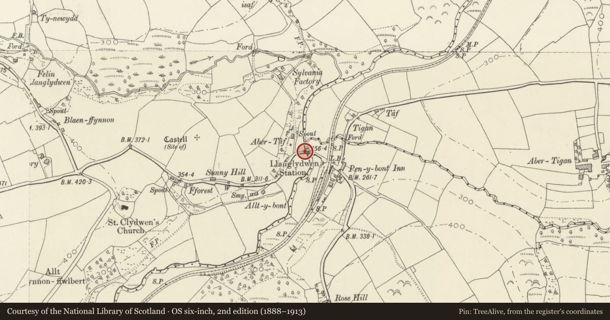
5 historical maps cover this location, the earliest the 1636 map "Cornubia : Devonia, Somersetus, Dorcestria, Wiltonia, Glocestria ..." (David Rumsey Map Collection, Stanford Libraries).
Historical maps covering this location
- 1636 · Cornubia : Devonia, Somersetus, Dorcestria, Wiltonia, Glocestria ... (David Rumsey Map Collection, Stanford Libraries)
- 1891 · Sheet 10. Ordnance Survey of England and Wales. . (David Rumsey Map Collection, Stanford Libraries)
- 1898 · 210 Cardigan (Hills) (David Rumsey Map Collection, Stanford Libraries)
- 1898 · 210 Cardigan (Outline) (David Rumsey Map Collection, Stanford Libraries)
- 1901 · Sheet 13. (David Rumsey Map Collection, Stanford Libraries)
Cadw's description
Location
Spanning the river Taf in the centre of the hamlet.
History
Road bridge over the River Taf, presumably the new bridge for which tenders were advertised and John
Thomas, the bridge surveyor for the county, was paid for the plans in 1823.
Exterior
A single-span rubble-stone, double-carriageway bridge ramped to the centre. It has a wide segmental arch of narrow voussoirs, and blind roundels in the spandrels. Abutments have broad shallow pilasters flanking circular flood apertures with voussoirs and part infilled with cement render. A continuous raised band is beneath the parapet, which retains a stone coping on the downstream (S) side but is replaced in concrete on the upstream (N) side. Terminal piers have saddleback copings. On both sides are curved stone approaches with copings.
Reason for designation
Listed as a substantial and well-designed Georgian road bridge in a style characteristic of the region.
Nearby in the register
- Pont Llanglydwen (partly in Cilymaenllwyd community)Transportunder 1 mi
- Church of St CledwynReligious, Ritual and Funeraryunder 1 mi
- Lychgate at St Cledwyn's ChurchReligious, Ritual and Funeraryunder 1 mi
- Llanglydwen Churchyard CrossCrossunder 1 mi
Other entries of the same register within about three miles of this one, by straight line.