Cof Cymru: National Historic Assets of Wales · Wales
Tomb of David Charles in Llangunnor churchyard
Llangunnor, Carmarthenshire, Wales
A Grade II listed building in Llangunnor, Carmarthenshire, designated on 16 January 2004.
The record
- Designation
- Listed building, Grade II
- Broad class
- No class recorded
- Date of designation
- 16 January 2004
- Locality
- Llangunnor
- Community
- Llangunnor
- Unitary authority
- Carmarthenshire
- Country
- Wales
- Coordinates
- 51.85885, -4.28110
- Cadw reference
- 82395
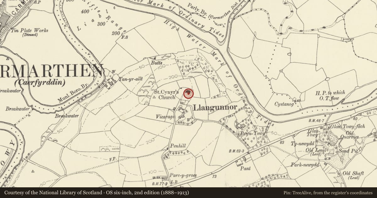
Slide toward Today to fade the historical sheet and see the modern map underneath.
David Rumsey Map Collection, Stanford LibrariesDavid Rumsey Map Collection, Stanford LibrariesDavid Rumsey Map Collection, Stanford LibrariesDavid Rumsey Map Collection, Stanford LibrariesDavid Rumsey Map Collection, Stanford Libraries
5 historical maps cover this location, the earliest the 1636 map "Cornubia : Devonia, Somersetus, Dorcestria, Wiltonia, Glocestria ..." (David Rumsey Map Collection, Stanford Libraries).
Historical maps covering this location
- 1636 · Cornubia : Devonia, Somersetus, Dorcestria, Wiltonia, Glocestria ... (David Rumsey Map Collection, Stanford Libraries)
- 1860 · 41. Caermathen. (David Rumsey Map Collection, Stanford Libraries)
- 1891 · Sheet 10. Ordnance Survey of England and Wales. . (David Rumsey Map Collection, Stanford Libraries)
- 1898 · 229 Carmarthen (Hills) (David Rumsey Map Collection, Stanford Libraries)
- 1901 · Sheet 14. (David Rumsey Map Collection, Stanford Libraries)
Cadw's description
Location
On the S side of the church.
History
The grave of David Charles (1762-1834), Calvinistic Methodist minister and hymn writer.
Exterior
A freestone chest tomb with blind Gothic arched panels at the angles. The W side has a memorial inscription. An inscription on the N side reads 'Awdur "O Fryniau Caersalem"', his best-known hymn.
Reason for designation
Listed for its special interest as the grave of an important figure in Welsh nonconformist history.
Nearby in the register
- Church of St CeinwrNo class recordedunder 1 mi
- Morris family tomb in Llangunnor churchyardNo class recordedunder 1 mi
- Former cottage on S side of Llangunnor churchyardNo class recordedunder 1 mi
- Bryn Towy MansionDomesticunder 1 mi
Other entries of the same register within about three miles of this one, by straight line.