Cof Cymru: National Historic Assets of Wales · Wales
Iron Footbridge over the Swansea Canal
Clydach, Swansea, Wales
A Grade II listed building in Clydach, Swansea, designated on 15 December 2003.
The record
- Designation
- Listed building, Grade II
- Broad class
- Transport
- Date of designation
- 15 December 2003
- Locality
- Clydach
- Town
- Swansea
- Community
- Clydach
- Unitary authority
- Swansea
- Country
- Wales
- Coordinates
- 51.69435, -3.89713
- Cadw reference
- 82327
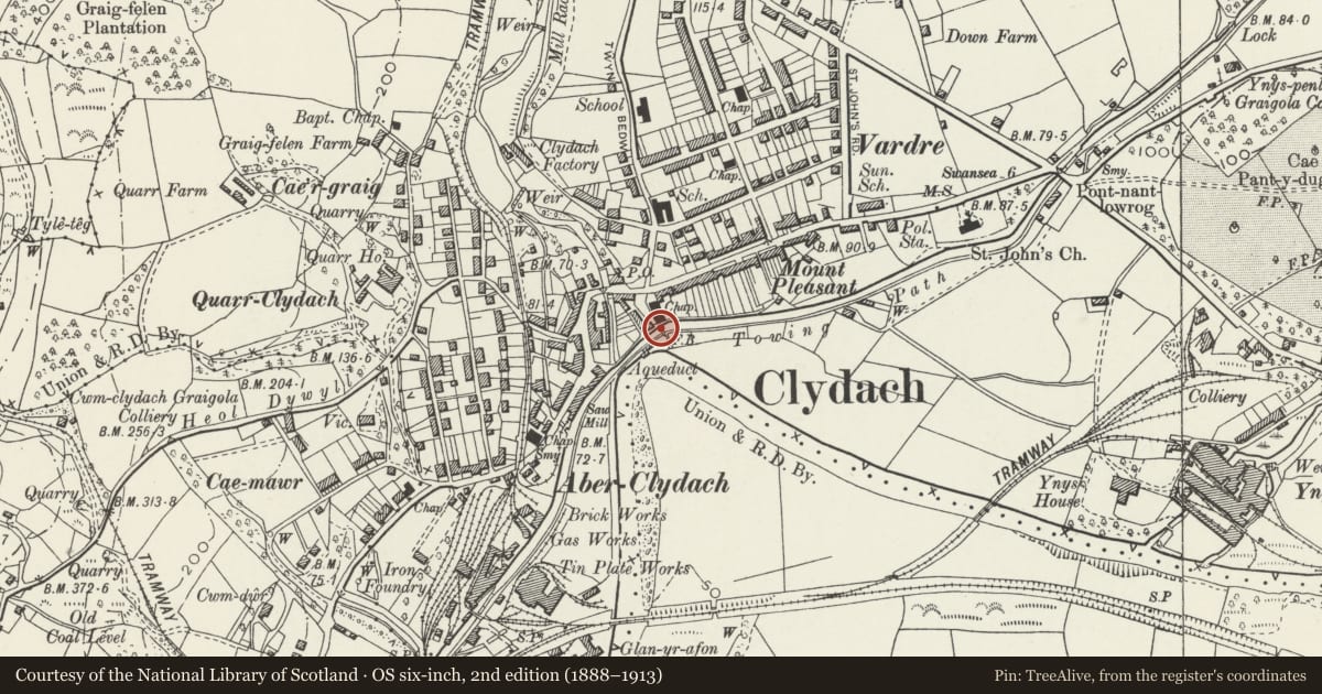
Slide toward Today to fade the historical sheet and see the modern map underneath.
David Rumsey Map Collection, Stanford LibrariesDavid Rumsey Map Collection, Stanford LibrariesDavid Rumsey Map Collection, Stanford LibrariesDavid Rumsey Map Collection, Stanford LibrariesDavid Rumsey Map Collection, Stanford Libraries
5 historical maps cover this location, the earliest the 1636 map "Cornubia : Devonia, Somersetus, Dorcestria, Wiltonia, Glocestria ..." (David Rumsey Map Collection, Stanford Libraries).
Historical maps covering this location
- 1636 · Cornubia : Devonia, Somersetus, Dorcestria, Wiltonia, Glocestria ... (David Rumsey Map Collection, Stanford Libraries)
- 1637 · The fourth table of England. Cornub. Devonia, Somerset etc. (David Rumsey Map Collection, Stanford Libraries)
- 1865 · England and Wales. England No. 6. (David Rumsey Map Collection, Stanford Libraries)
- 1891 · Sheet 10. Ordnance Survey of England and Wales. . (David Rumsey Map Collection, Stanford Libraries)
- 1897 · 247 Swansea (Hills) (David Rumsey Map Collection, Stanford Libraries)
Cadw's description
Location
Crossing the Swansea Canal just S of Capel Calfaria and some 75m NE of the junction of the Lower Clydach River and the Afon Tawe.
History
Footbridge over the Swansea Canal, dated 1887. The 16-mile Swansea Canal was opened in 1798 to Hen Neuadd, Abercraf, declined after the railway opened in 1852 and closed in 1931. The bridge was installed by the Swansea Canal Company as a toll bridge and later the toll rights were sold to a local mining company. Said to have been made by the Neath Abbey Ironworks but this closed in 1886 a year before the date on the stone piers.
Exterior
Footbridge, of two large I-beams made up of rivetted plates joined by T-section pieces, with flat bottom piece and top handrail made up of two hollow rails bolted back-to-back. Decking and linking struts beneath replaced in late C20. Bridge is supported on rubble stone piers with rubble stone ramp up each side from towpaths, ramps of coursed rock-faced squared rubble stone with sloping parapets.
Reason for designation
Included for its special historic interest as an unusual surviving industrial footbridge.
Nearby in the register
- Capel CalfariaReligious, Ritual and Funeraryunder 1 mi
- Piers and railings at Calfaria Baptist ChapelNo class recordedunder 1 mi
- Swansea Canal aqueduct over the Lower Clydach RiverTransportunder 1 mi
- Church of Saint MaryReligious, Ritual and Funeraryunder 1 mi
Other entries of the same register within about three miles of this one, by straight line.