Cof Cymru: National Historic Assets of Wales · Wales
Goose rearing shelters and mounting block at Tan-y-rhiw
Blaenhonddan, Neath Port Talbot, Wales
A Grade II listed building in Cilfrew, Neath, Blaenhonddan, Neath Port Talbot, designated on 26 November 2003.
The record
- Designation
- Listed building, Grade II
- Broad class
- Agriculture and Subsistence
- Date of designation
- 26 November 2003
- Locality
- Cilfrew
- Town
- Neath
- Community
- Blaenhonddan
- Unitary authority
- Neath Port Talbot
- Country
- Wales
- Coordinates
- 51.69912, -3.77100
- Cadw reference
- 82086
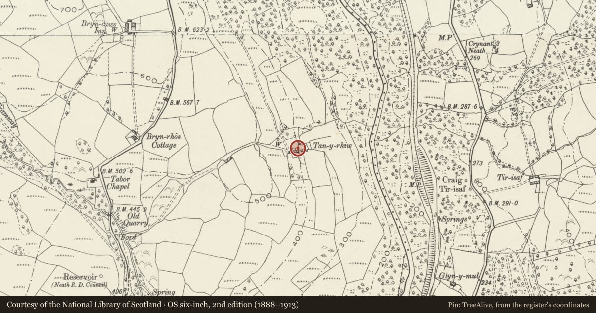
Slide toward Today to fade the historical sheet and see the modern map underneath.
David Rumsey Map Collection, Stanford LibrariesDavid Rumsey Map Collection, Stanford LibrariesDavid Rumsey Map Collection, Stanford LibrariesDavid Rumsey Map Collection, Stanford LibrariesDavid Rumsey Map Collection, Stanford Libraries
5 historical maps cover this location, the earliest the 1636 map "Cornubia : Devonia, Somersetus, Dorcestria, Wiltonia, Glocestria ..." (David Rumsey Map Collection, Stanford Libraries).
Historical maps covering this location
- 1636 · Cornubia : Devonia, Somersetus, Dorcestria, Wiltonia, Glocestria ... (David Rumsey Map Collection, Stanford Libraries)
- 1637 · The fourth table of England. Cornub. Devonia, Somerset etc. (David Rumsey Map Collection, Stanford Libraries)
- 1865 · England and Wales. England No. 6. (David Rumsey Map Collection, Stanford Libraries)
- 1891 · Sheet 10. Ordnance Survey of England and Wales. . (David Rumsey Map Collection, Stanford Libraries)
- 1898 · 230 Ammanford (Hills) (David Rumsey Map Collection, Stanford Libraries)
Cadw's description
Location
Situated to the W of and just uphill from the farmhouse at Tan-y-rhiw.
History
Set of goose rearing pens build into a bank, uncertain date possibly early C19, though situated near a farmhouse of C17 origins. Mounting block set to left.
Exterior
The goose rearing shelters are rough stone chambers built into a low stone and earth bank. Three square entries with upright stone slabs between, stone slab lintels and roughly vaulted stone chambers within.
Reason for designation
Included for special historic interest as an extremely rare surviving example of goose rearing shelters. The structures utilise ancient building techniques with stone lintels.
Nearby in the register
- Two Platform Houses 1600m SE of Blaen-Nant FarmPlatform house1 mi
- Cefn Coed Colliery, No. 1 Shaft HeadframeIndustrial1 mi
- Cefn Coed Colliery Engine House Range and Steam Capstan EngineIndustrial1 mi
- Seion Fforest Calvinistic Methodist ChapelReligious, Ritual and Funerary1 mi
Other entries of the same register within about three miles of this one, by straight line.